Sharanga geodata
Sharanga (Nizhny Novgorod Oblast) is a populated place; located in Russia in Europe/Moscow (GMT+3) time zone. With population of 6,709 people, there are 2072 cities with bigger population in this country. Compared to other cities in Russia, 78.4% of cities are located further ↓South; 54.3% of cities are located further ←West and 51.9% of cities have lower elevation than Sharanga. Note1


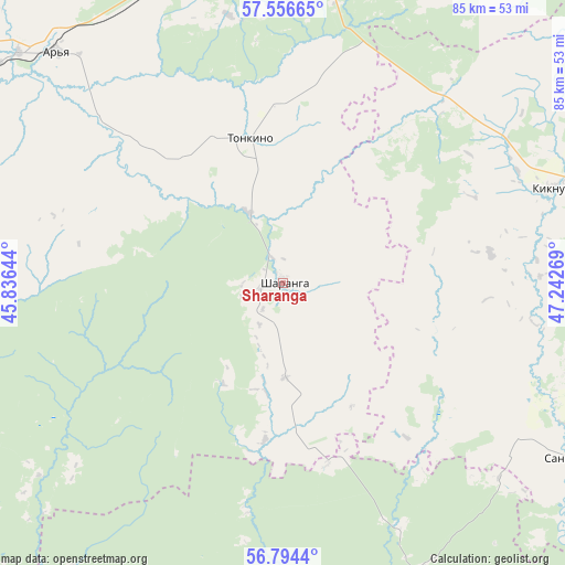
Sharanga GPS coordinates[2]
57° 10' 38.964" North, 46° 32' 22.416" East
| Map corner | latitude | longitude |
|---|---|---|
| Upper-left | 57.55665°, | 45.83644° |
| Center: | 57.17749°, | 46.53956° |
| Lower-right: | 56.7944°, | 47.24269° |
| Map W x H: | 84.8×84.8 km | = 52.7×52.7mi |
| max Lat: | 73.50819° ⇑21.6% North |
| Sharanga: | 57.17749° |
| min Lat: | ⇓78.4% South 41.28413° |
| min Long | Sharanga | max Long |
| -179.12198° | 46.53956° | 179.35046° |
| W 54.3%⇐ | ⇒45.7% E |
Elevation
Elevation of Sharanga is 149 m = 489 ft, and this is 53.6 m = 176 ft below average elevation for this country.
| Max E: |
2518 m = 8261 ft | 48.1% |
| Avg. | 202.6 m = 665 ft | |
| Sharanga | 149 m = 489 ft | |
Min E: |
-28 m = -92 ft | 51.9% |
See also: Russia elevation on elevation.city.
Geographical zone
Sharanga is located in North temperate zone (between Tropic of Cancer and the Arctic Circle). Distance of this North polar circle is 1043.6 km =648.5 mi to North.| Distance of | km | miles | from Sharanga |
|---|---|---|---|
| North Pole | 3649.5 | 2267.7 | to North |
| Arctic Circle | 1043.6 | 648.5 | to North |
| Tropic Cancer | 3751.6 | 2331.1 | to South |
| Equator | 6357.5 | 3950.4 | to South |


Nearby cities:
15 places around Sharanga: (largest is in red/bold)
• Ar’ya
49 km =30.4 mi,  315°
315°
• Kiknur
42.2 km =26.2 mi,  70°
70°
• Kilemary
48.6 km =30.2 mi,  155°
155°
• Krasnyye Baki
83.4 km =51.8 mi,  266°
266°
• Pizhma
83.8 km =52.1 mi,  24°
24°
• Prudy
46.9 km =29.1 mi,  339°
339°
• Sanchursk
50.3 km =31.3 mi,  121°
121°
• Shakhun’ya
55.6 km =34.5 mi,  4°
4°
• Shaygino
68.4 km =42.5 mi, 16°
• Tonkino
22.2 km =13.8 mi,  348°
348°
• Tonshayevo
68.2 km =42.4 mi, 24°
• Uren’
54.8 km =34.1 mi,  304°
304°
• Vetluzhskiy
85.4 km =53.1 mi, 269°
• Voskresenskoye
77 km =47.8 mi,  240°
240°
• Yaransk
82.2 km =51.1 mi,  80°
80°
Sources, notices
• [Note1] Compared only with cities in Russia existing in our database
• [Src1] Map data: © OpenStreetMap contributors (CC-BY-SA)
• [Src2] Other city data from geonames.org with taken over terms of usage.
• [Src3] Geographical zone / Annual Mean Temperature by Robert A. Rohde @ Wikipedia
