Shaygino geodata
Shaygino (Nizhny Novgorod Oblast) is a populated place; located in Russia in Europe/Moscow (GMT+3) time zone. With population of 876 people, there are 4716 cities with bigger population in this country. Compared to other cities in Russia, 81.4% of cities are located further ↓South; 55.6% of cities are located further ←West and 55.3% of cities have lower elevation than Shaygino. Note1


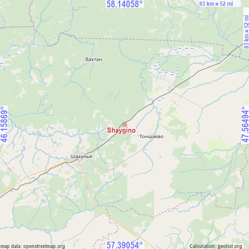
Shaygino GPS coordinates[2]
57° 46' 3.036" North, 46° 51' 42.516" East
| Map corner | latitude | longitude |
|---|---|---|
| Upper-left | 58.14058°, | 46.15869° |
| Center: | 57.76751°, | 46.86181° |
| Lower-right: | 57.39054°, | 47.56494° |
| Map W x H: | 83.4×83.4 km | = 51.8×51.8mi |
| max Lat: | 73.50819° ⇑18.6% North |
| Shaygino: | 57.76751° |
| min Lat: | ⇓81.4% South 41.28413° |
| min Long | Shaygino | max Long |
| -179.12198° | 46.86181° | 179.35046° |
| W 55.6%⇐ | ⇒44.4% E |
Elevation
Elevation of Shaygino is 157 m = 515 ft, and this is 45.6 m = 150 ft below average elevation for this country.
| Max E: |
2518 m = 8261 ft | 44.7% |
| Avg. | 202.6 m = 665 ft | |
| Shaygino | 157 m = 515 ft | |
Min E: |
-28 m = -92 ft | 55.3% |
See also: Russia elevation on elevation.city.
Geographical zone
Shaygino is located in North temperate zone (between Tropic of Cancer and the Arctic Circle). Distance of this North polar circle is 978 km =607.7 mi to North.| Distance of | km | miles | from Shaygino |
|---|---|---|---|
| North Pole | 3583.9 | 2226.9 | to North |
| Arctic Circle | 978 | 607.7 | to North |
| Tropic Cancer | 3817.2 | 2371.9 | to South |
| Equator | 6423.1 | 3991.1 | to South |


Nearby cities:
15 places around Shaygino: (largest is in red/bold)
• Ar’ya
61.5 km =38.2 mi,  240°
240°
• Kiknur
55.4 km =34.4 mi,  158°
158°
• Leninskoye
62.5 km =38.8 mi,  12°
12°
• Pizhma
18.6 km =11.6 mi,  54°
54°
• Prudy
41.2 km =25.6 mi, 238°
• Shakhun’ya
18 km =11.2 mi, 235°
• Sharanga
68.4 km =42.5 mi,  196°
196°
• Svecha
68.7 km =42.7 mi,  34°
34°
• Syava
42.1 km =26.2 mi,  310°
310°
• Tonkino
49.9 km =31 mi,  208°
208°
• Tonshayevo
9.6 km =6 mi,  111°
111°
• Tuzha
66.3 km =41.2 mi, 105°
• Uren’
72.9 km =45.3 mi, 241°
• Vakhtan
24.3 km =15.1 mi,  335°
335°
• Vetluga
64.8 km =40.3 mi,  278°
278°
Sources, notices
• [Note1] Compared only with cities in Russia existing in our database
• [Src1] Map data: © OpenStreetMap contributors (CC-BY-SA)
• [Src2] Other city data from geonames.org with taken over terms of usage.
• [Src3] Geographical zone / Annual Mean Temperature by Robert A. Rohde @ Wikipedia
