Priyutovo geodata
Priyutovo (Bashkortostan Republic) is a populated place; located in Russia in Asia/Yekaterinburg (GMT+5) time zone. With population of 20,847 people, there are 840 cities with bigger population in this country. Compared to other cities in Russia, 56.1% of cities are located further ↑North; 65.6% of cities are located further ←West and 83.6% of cities have lower elevation than Priyutovo. Note1


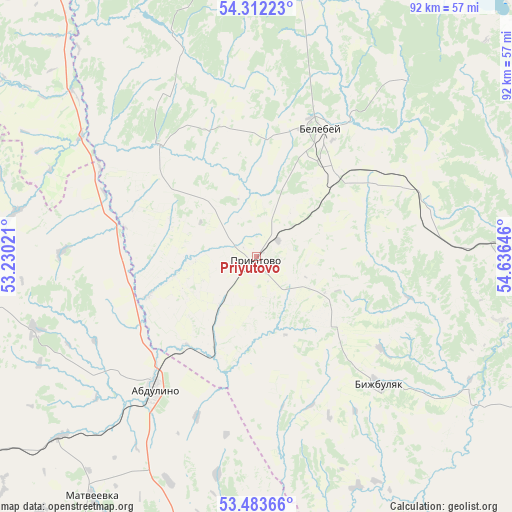
Priyutovo GPS coordinates[2]
53° 54' 0" North, 53° 55' 59.988" East
| Map corner | latitude | longitude |
|---|---|---|
| Upper-left | 54.31223°, | 53.23021° |
| Center: | 53.9°, | 53.93333° |
| Lower-right: | 53.48366°, | 54.63646° |
| Map W x H: | 92.1×92.1 km | = 57.2×57.2mi |
| max Lat: | 73.50819° ⇑56.1% North |
| Priyutovo: | 53.9° |
| min Lat: | ⇓43.9% South 41.28413° |
| min Long | Priyutovo | max Long |
| -179.12198° | 53.93333° | 179.35046° |
| W 65.6%⇐ | ⇒34.4% E |
Elevation
Elevation of Priyutovo is 295 m = 968 ft, and this is 92.4 m = 303 ft above average elevation for this country.
| Max E: |
2518 m = 8261 ft | 16.4% |
| Priyutovo | 295 m 968 ft | |
| Avg. | 202.6 m = 665 ft | |
Min E: |
-28 m = -92 ft | 83.6% |
See also: Russia elevation on elevation.city.
Geographical zone
Priyutovo is located in North temperate zone (between Tropic of Cancer and the Arctic Circle). Distance of this North polar circle is 1408.1 km =875 mi to North.| Distance of | km | miles | from Priyutovo |
|---|---|---|---|
| North Pole | 4013.9 | 2494.1 | to North |
| Arctic Circle | 1408.1 | 875 | to North |
| Tropic Cancer | 3387.2 | 2104.7 | to South |
| Equator | 5993.1 | 3723.9 | to South |


Nearby cities:
15 places around Priyutovo: (largest is in red/bold)
• Abdulino
28.3 km =17.6 mi,  218°
218°
• Aksakovo
20.5 km =12.7 mi,  43°
43°
• Bavly
70.2 km =43.6 mi,  321°
321°
• Belebey
26.9 km =16.7 mi,  26°
26°
• Bizhbulyak
31.4 km =19.5 mi,  136°
136°
• Kandry
75.1 km =46.7 mi,  9°
9°
• Kirgiz-Miyaki
64.1 km =39.8 mi,  117°
117°
• Nizhnetroitskiy
51.4 km =31.9 mi,  341°
341°
• Novomikhaylovskiy
13.1 km =8.1 mi,  90°
90°
• Oktyabr’skiy
71.3 km =44.3 mi, 335°
• Rayevskiy
68.8 km =42.8 mi,  74°
74°
• Serafimovskiy
59 km =36.7 mi,  351°
351°
• Shafranovo
55.1 km =34.2 mi,  82°
82°
• Subkhankulovo
73.5 km =45.7 mi, 353°
• Yermekeyevo
26 km =16.2 mi, 318°
Sources, notices
• [Note1] Compared only with cities in Russia existing in our database
• [Src1] Map data: © OpenStreetMap contributors (CC-BY-SA)
• [Src2] Other city data from geonames.org with taken over terms of usage.
• [Src3] Geographical zone / Annual Mean Temperature by Robert A. Rohde @ Wikipedia
