Yermekeyevo geodata
Yermekeyevo (Bashkortostan Republic) is a populated place; located in Russia in Asia/Yekaterinburg (GMT+5) time zone. With population of 4,214 people, there are 2990 cities with bigger population in this country. Compared to other cities in Russia, 54.6% of cities are located further ↑North; 65.3% of cities are located further ←West and 52.4% of cities have lower elevation than Yermekeyevo. Note1


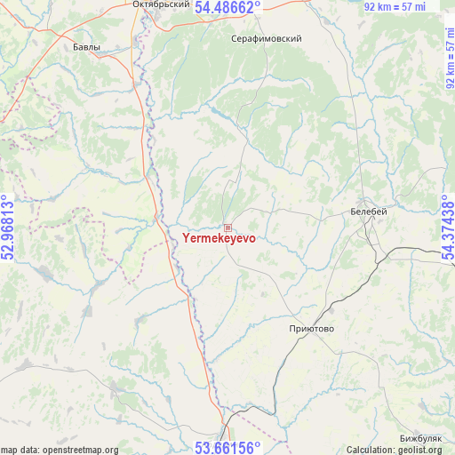
Yermekeyevo GPS coordinates[2]
54° 4' 34.104" North, 53° 40' 16.5" East
| Map corner | latitude | longitude |
|---|---|---|
| Upper-left | 54.48662°, | 52.96813° |
| Center: | 54.07614°, | 53.67125° |
| Lower-right: | 53.66156°, | 54.37438° |
| Map W x H: | 91.7×91.7 km | = 57×57mi |
| max Lat: | 73.50819° ⇑54.6% North |
| Yermekeyevo: | 54.07614° |
| min Lat: | ⇓45.4% South 41.28413° |
| min Long | Yermekeyevo | max Long |
| -179.12198° | 53.67125° | 179.35046° |
| W 65.3%⇐ | ⇒34.7% E |
Elevation
Elevation of Yermekeyevo is 150 m = 492 ft, and this is 52.6 m = 173 ft below average elevation for this country.
| Max E: |
2518 m = 8261 ft | 47.6% |
| Avg. | 202.6 m = 665 ft | |
| Yermekeyevo | 150 m = 492 ft | |
Min E: |
-28 m = -92 ft | 52.4% |
See also: Russia elevation on elevation.city.
Geographical zone
Yermekeyevo is located in North temperate zone (between Tropic of Cancer and the Arctic Circle). Distance of this North polar circle is 1388.5 km =862.8 mi to North.| Distance of | km | miles | from Yermekeyevo |
|---|---|---|---|
| North Pole | 3994.4 | 2482 | to North |
| Arctic Circle | 1388.5 | 862.8 | to North |
| Tropic Cancer | 3406.8 | 2116.9 | to South |
| Equator | 6012.7 | 3736.1 | to South |


Nearby cities:
15 places around Yermekeyevo: (largest is in red/bold)
• Abdulino
41.8 km =26 mi,  180°
180°
• Aksakovo
31.6 km =19.6 mi,  98°
98°
• Bavly
44.2 km =27.5 mi,  322°
322°
• Belebey
29.4 km =18.3 mi,  81°
81°
• Bizhbulyak
57.4 km =35.7 mi,  137°
137°
• Kandry
61.7 km =38.3 mi,  27°
27°
• Nizhnetroitskiy
29.2 km =18.1 mi,  1°
1°
• Novomikhaylovskiy
36 km =22.4 mi,  122°
122°
• Oktyabr’skiy
46.9 km =29.1 mi,  343°
343°
• Priyutovo
26 km =16.2 mi, 138°
• Serafimovskiy
39.5 km =24.5 mi,  11°
11°
• Shafranovo
72.6 km =45.1 mi, 99°
• Subkhankulovo
54.3 km =33.7 mi, 9°
• Tuymazy
59 km =36.7 mi, 2°
• Urussu
59.6 km =37 mi,  346°
346°
Sources, notices
• [Note1] Compared only with cities in Russia existing in our database
• [Src1] Map data: © OpenStreetMap contributors (CC-BY-SA)
• [Src2] Other city data from geonames.org with taken over terms of usage.
• [Src3] Geographical zone / Annual Mean Temperature by Robert A. Rohde @ Wikipedia
