Kandry geodata
Kandry (Bashkortostan Republic) is a populated place; located in Russia in Asia/Yekaterinburg (GMT+5) time zone. With population of 12,100 people, there are 1263 cities with bigger population in this country. Compared to other cities in Russia, 50.6% of cities are located further ↑North; 65.7% of cities are located further ←West and 59.9% of cities have lower elevation than Kandry. Note1


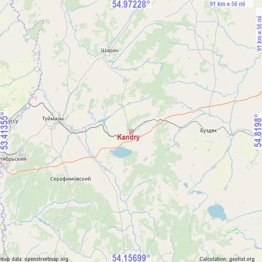
Kandry GPS coordinates[2]
54° 34' 0.012" North, 54° 7' 0.012" East
| Map corner | latitude | longitude |
|---|---|---|
| Upper-left | 54.97228°, | 53.41355° |
| Center: | 54.56667°, | 54.11667° |
| Lower-right: | 54.15699°, | 54.8198° |
| Map W x H: | 90.7×90.6 km | = 56.4×56.3mi |
| max Lat: | 73.50819° ⇑50.6% North |
| Kandry: | 54.56667° |
| min Lat: | ⇓49.4% South 41.28413° |
| min Long | Kandry | max Long |
| -179.12198° | 54.11667° | 179.35046° |
| W 65.7%⇐ | ⇒34.3% E |
Elevation
Elevation of Kandry is 168 m = 551 ft, and this is 34.6 m = 114 ft below average elevation for this country.
| Max E: |
2518 m = 8261 ft | 40.1% |
| Avg. | 202.6 m = 665 ft | |
| Kandry | 168 m = 551 ft | |
Min E: |
-28 m = -92 ft | 59.9% |
See also: Russia elevation on elevation.city.
Geographical zone
Kandry is located in North temperate zone (between Tropic of Cancer and the Arctic Circle). Distance of this North polar circle is 1333.9 km =828.8 mi to North.| Distance of | km | miles | from Kandry |
|---|---|---|---|
| North Pole | 3939.8 | 2448.1 | to North |
| Arctic Circle | 1333.9 | 828.8 | to North |
| Tropic Cancer | 3461.3 | 2150.8 | to South |
| Equator | 6067.2 | 3770 | to South |


Nearby cities:
15 places around Kandry: (largest is in red/bold)
• Aksakovo
59.3 km =36.8 mi,  177°
177°
• Bakaly
71 km =44.1 mi,  343°
343°
• Bavly
58.6 km =36.4 mi,  250°
250°
• Belebey
50 km =31.1 mi, 180°
• Buzdyak
28 km =17.4 mi,  86°
86°
• Chekmagush
71.7 km =44.6 mi,  28°
28°
• Davlekanovo
70.7 km =43.9 mi,  122°
122°
• Nizhnetroitskiy
37.8 km =23.5 mi,  227°
227°
• Oktyabr’skiy
42.7 km =26.5 mi,  257°
257°
• Serafimovskiy
26.1 km =16.2 mi, 232°
• Sharan
28.8 km =17.9 mi, 344°
• Subkhankulovo
19.7 km =12.2 mi,  267°
267°
• Tuymazy
26.6 km =16.5 mi,  279°
279°
• Urussu
42.3 km =26.3 mi, 274°
• Yermekeyevo
61.7 km =38.3 mi,  207°
207°
Sources, notices
• [Note1] Compared only with cities in Russia existing in our database
• [Src1] Map data: © OpenStreetMap contributors (CC-BY-SA)
• [Src2] Other city data from geonames.org with taken over terms of usage.
• [Src3] Geographical zone / Annual Mean Temperature by Robert A. Rohde @ Wikipedia
