Subkhankulovo geodata
Subkhankulovo (Bashkortostan Republic) is a populated place; located in Russia in Asia/Yekaterinburg (GMT+5) time zone. With population of 5,674 people, there are 2371 cities with bigger population in this country. Compared to other cities in Russia, 50.7% of cities are located further ↑North; 65.5% of cities are located further ←West and 62.5% of cities have higher elevation than Subkhankulovo. Note1


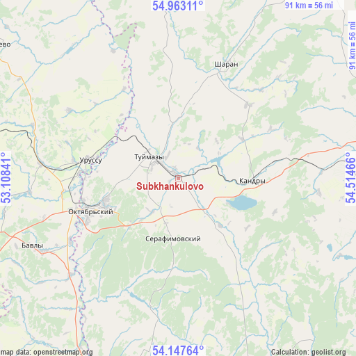
Subkhankulovo GPS coordinates[2]
54° 33' 26.676" North, 53° 48' 41.508" East
| Map corner | latitude | longitude |
|---|---|---|
| Upper-left | 54.96311°, | 53.10841° |
| Center: | 54.55741°, | 53.81153° |
| Lower-right: | 54.14764°, | 54.51466° |
| Map W x H: | 90.7×90.7 km | = 56.4×56.4mi |
| max Lat: | 73.50819° ⇑50.7% North |
| Subkhankulovo: | 54.55741° |
| min Lat: | ⇓49.3% South 41.28413° |
| min Long | Subkhankulovo | max Long |
| -179.12198° | 53.81153° | 179.35046° |
| W 65.5%⇐ | ⇒34.5% E |
Elevation
Elevation of Subkhankulovo is 119 m = 390 ft, and this is 83.6 m = 274 ft below average elevation for this country.
| Max E: |
2518 m = 8261 ft | 62.5% |
| Avg. | 202.6 m = 665 ft | |
| Subkhankulovo | 119 m = 390 ft | |
Min E: |
-28 m = -92 ft | 37.5% |
See also: Russia elevation on elevation.city.
Geographical zone
Subkhankulovo is located in North temperate zone (between Tropic of Cancer and the Arctic Circle). Distance of this North polar circle is 1335 km =829.5 mi to North.| Distance of | km | miles | from Subkhankulovo |
|---|---|---|---|
| North Pole | 3940.8 | 2448.7 | to North |
| Arctic Circle | 1335 | 829.5 | to North |
| Tropic Cancer | 3460.3 | 2150.1 | to South |
| Equator | 6066.2 | 3769.4 | to South |


Nearby cities:
15 places around Subkhankulovo: (largest is in red/bold)
• Aksakovo
62.3 km =38.7 mi,  159°
159°
• Aktyubinskiy
70.7 km =43.9 mi,  293°
293°
• Bakaly
69.1 km =42.9 mi,  359°
359°
• Bavly
40 km =24.9 mi,  242°
242°
• Belebey
52.8 km =32.8 mi, 158°
• Bugul’ma
65.4 km =40.6 mi,  268°
268°
• Buzdyak
47.7 km =29.6 mi,  86°
86°
• Kandry
19.7 km =12.2 mi, 87°
• Nizhnetroitskiy
25.7 km =16 mi,  198°
198°
• Oktyabr’skiy
23.5 km =14.6 mi,  248°
248°
• Serafimovskiy
14.9 km =9.3 mi,  183°
183°
• Sharan
31.3 km =19.4 mi,  22°
22°
• Tuymazy
8.5 km =5.3 mi,  309°
309°
• Urussu
22.9 km =14.2 mi,  281°
281°
• Yermekeyevo
54.3 km =33.7 mi,  189°
189°
Sources, notices
• [Note1] Compared only with cities in Russia existing in our database
• [Src1] Map data: © OpenStreetMap contributors (CC-BY-SA)
• [Src2] Other city data from geonames.org with taken over terms of usage.
• [Src3] Geographical zone / Annual Mean Temperature by Robert A. Rohde @ Wikipedia
