Primorsko-Akhtarsk geodata
Primorsko-Akhtarsk (Krasnodarskiy) is a seat of a second-order administrative division; located in Russia in Europe/Moscow (GMT+3) time zone. With population of 33,102 people, there are 606 cities with bigger population in this country. Compared to other cities in Russia, 84.1% of cities are located further ↑North; 76.1% of cities are located further →East and 98.1% of cities have higher elevation than Primorsko-Akhtarsk. Note1


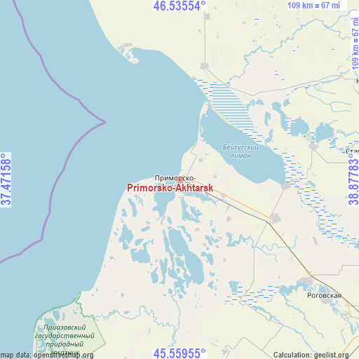
Primorsko-Akhtarsk GPS coordinates[2]
46° 2' 58.92" North, 38° 10' 28.92" East
| Map corner | latitude | longitude |
|---|---|---|
| Upper-left | 46.53554°, | 37.47158° |
| Center: | 46.0497°, | 38.1747° |
| Lower-right: | 45.55955°, | 38.87783° |
| Map W x H: | 108.5×108.5 km | = 67.4×67.4mi |
| max Lat: | 73.50819° ⇑84.1% North |
| Primorsko-Akhtarsk: | 46.0497° |
| min Lat: | ⇓15.9% South 41.28413° |
| min Long | Primorsko-Akhta | max Long |
| -179.12198° | 38.1747° | 179.35046° |
| W 23.9%⇐ | ⇒76.1% E |
Elevation
Elevation of Primorsko-Akhtarsk is 4 m = 13 ft, and this is 198.6 m = 652 ft below average elevation for this country.
| Max E: |
2518 m = 8261 ft | 98.1% |
| Avg. | 202.6 m = 665 ft | |
| Primorsko-Akhtarsk | 4 m = 13 ft | |
Min E: |
-28 m = -92 ft | 1.9% |
See also: Russia elevation on elevation.city.
Geographical zone
Primorsko-Akhtarsk is located in North temperate zone (between Tropic of Cancer and the Arctic Circle). Distance of this North polar circle is 2280.9 km =1417.3 mi to North.| Distance of | km | miles | from Primorsko-Akhtarsk |
|---|---|---|---|
| North Pole | 4886.8 | 3036.5 | to North |
| Arctic Circle | 2280.9 | 1417.3 | to North |
| Tropic Cancer | 2514.3 | 1562.3 | to South |
| Equator | 5120.2 | 3181.5 | to South |


Nearby cities:
15 places around Primorsko-Akhtarsk: (largest is in red/bold)
• Dneprovskaya
68.2 km =42.4 mi,  133°
133°
• Grivenskaya
44.7 km =27.8 mi,  179°
179°
• Kamyshevatskaya
43.8 km =27.2 mi,  337°
337°
• Kanevskaya
60.7 km =37.7 mi,  86°
86°
• Kopanskaya
34.6 km =21.5 mi,  42°
42°
• Novoderevyankovskaya
53.5 km =33.2 mi,  55°
55°
• Novodzhereliyevskaya
49.2 km =30.6 mi, 128°
• Novominskaya
67.2 km =41.8 mi, 63°
• Novoshcherbinovskaya
59.8 km =37.2 mi, 37°
• Ol’ginskaya
31.1 km =19.3 mi,  111°
111°
• Rogovskaya
56.3 km =35 mi, 129°
• Staroderevyankovskaya
61.7 km =38.3 mi,  81°
81°
• Starodzhereliyevskaya
64.5 km =40.1 mi,  171°
171°
• Vorontsovka
67.5 km =41.9 mi,  353°
353°
• Yasenskaya
35.2 km =21.9 mi,  11°
11°
In other languages:
- In Spanish: Primorsko-Ajtarsk
- In German: Primorsko-Achtarsk
- In Italian: Primorsko-Achtarsk
- In Russian: Приморско-Ахтарск
- In Chinese: 濱海阿赫塔爾斯克
Sources, notices
• [Note1] Compared only with cities in Russia existing in our database
• [Src1] Map data: © OpenStreetMap contributors (CC-BY-SA)
• [Src2] Other city data from geonames.org with taken over terms of usage.
• [Src3] Geographical zone / Annual Mean Temperature by Robert A. Rohde @ Wikipedia
