Ol’ginskaya geodata
Ol’ginskaya (Krasnodarskiy) is a populated place; located in Russia in Europe/Moscow (GMT+3) time zone. With population of 4,441 people, there are 2895 cities with bigger population in this country. Compared to other cities in Russia, 84.2% of cities are located further ↑North; 74.2% of cities are located further →East and 98.1% of cities have higher elevation than Ol’ginskaya. Note1


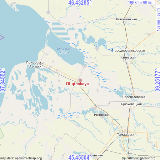
Ol’ginskaya GPS coordinates[2]
45° 56' 45.96" North, 38° 32' 55.104" East
| Map corner | latitude | longitude |
|---|---|---|
| Upper-left | 46.43285°, | 37.84552° |
| Center: | 45.9461°, | 38.54864° |
| Lower-right: | 45.45504°, | 39.25177° |
| Map W x H: | 108.7×108.7 km | = 67.5×67.5mi |
| max Lat: | 73.50819° ⇑84.2% North |
| Ol’ginskaya: | 45.9461° |
| min Lat: | ⇓15.8% South 41.28413° |
| min Long | Ol’ginskaya | max Long |
| -179.12198° | 38.54864° | 179.35046° |
| W 25.8%⇐ | ⇒74.2% E |
Elevation
Elevation of Ol’ginskaya is 4 m = 13 ft, and this is 198.6 m = 652 ft below average elevation for this country.
| Max E: |
2518 m = 8261 ft | 98.1% |
| Avg. | 202.6 m = 665 ft | |
| Ol’ginskaya | 4 m = 13 ft | |
Min E: |
-28 m = -92 ft | 1.9% |
See also: Russia elevation on elevation.city.
Geographical zone
Ol’ginskaya is located in North temperate zone (between Tropic of Cancer and the Arctic Circle). Distance of this North polar circle is 2292.4 km =1424.4 mi to North.| Distance of | km | miles | from Ol’ginskaya |
|---|---|---|---|
| North Pole | 4898.3 | 3043.7 | to North |
| Arctic Circle | 2292.4 | 1424.4 | to North |
| Tropic Cancer | 2502.8 | 1555.2 | to South |
| Equator | 5108.7 | 3174.4 | to South |


Nearby cities:
15 places around Ol’ginskaya: (largest is in red/bold)
• Bryukhovetskaya
38.2 km =23.7 mi,  114°
114°
• Dneprovskaya
41.1 km =25.5 mi,  150°
150°
• Grivenskaya
44 km =27.3 mi,  221°
221°
• Kalininskaya
52.1 km =32.4 mi,  170°
170°
• Kanevskaya
35.3 km =21.9 mi,  64°
64°
• Kopanskaya
37.3 km =23.2 mi,  351°
351°
• Novoderevyankovskaya
44.6 km =27.7 mi,  20°
20°
• Novodzhereliyevskaya
21.4 km =13.3 mi, 153°
• Novominskaya
51.9 km =32.2 mi,  37°
37°
• Pereyaslovskaya
38.6 km =24 mi, 107°
• Primorsko-Akhtarsk
31.1 km =19.3 mi,  291°
291°
• Rogovskaya
28.1 km =17.5 mi, 148°
• Staroderevyankovskaya
38.1 km =23.7 mi, 58°
• Timashëvsk
47.8 km =29.7 mi,  139°
139°
• Yasenskaya
50.7 km =31.5 mi,  334°
334°
Sources, notices
• [Note1] Compared only with cities in Russia existing in our database
• [Src1] Map data: © OpenStreetMap contributors (CC-BY-SA)
• [Src2] Other city data from geonames.org with taken over terms of usage.
• [Src3] Geographical zone / Annual Mean Temperature by Robert A. Rohde @ Wikipedia
