Starodzhereliyevskaya geodata
Starodzhereliyevskaya (Krasnodarskiy) is a populated place; located in Russia in Europe/Moscow (GMT+3) time zone. With population of 3,106 people, there are 3686 cities with bigger population in this country. Compared to other cities in Russia, 85.2% of cities are located further ↑North; 75.3% of cities are located further →East and 98.5% of cities have higher elevation than Starodzhereliyevskaya. Note1


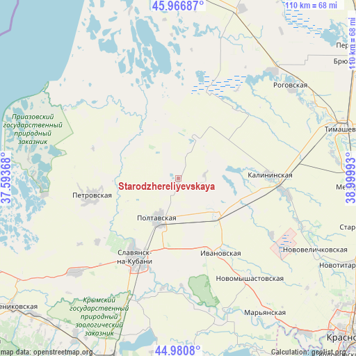
Starodzhereliyevskaya GPS coordinates[2]
45° 28' 33.564" North, 38° 17' 48.48" East
| Map corner | latitude | longitude |
|---|---|---|
| Upper-left | 45.96687°, | 37.59368° |
| Center: | 45.47599°, | 38.2968° |
| Lower-right: | 44.9808°, | 38.99993° |
| Map W x H: | 109.6×109.6 km | = 68.1×68.1mi |
| max Lat: | 73.50819° ⇑85.2% North |
| Starodzhereliyevskaya: | 45.47599° |
| min Lat: | ⇓14.8% South 41.28413° |
| min Long | Starodzhereliye | max Long |
| -179.12198° | 38.2968° | 179.35046° |
| W 24.7%⇐ | ⇒75.3% E |
Elevation
Elevation of Starodzhereliyevskaya is 2 m = 7 ft, and this is 200.6 m = 658 ft below average elevation for this country.
| Max E: |
2518 m = 8261 ft | 98.5% |
| Avg. | 202.6 m = 665 ft | |
| Starodzhereliyevskaya | 2 m = 7 ft | |
Min E: |
-28 m = -92 ft | 1.5% |
See also: Russia elevation on elevation.city.
Geographical zone
Starodzhereliyevskaya is located in North temperate zone (between Tropic of Cancer and the Arctic Circle). Distance of this North polar circle is 2344.7 km =1456.9 mi to North.| Distance of | km | miles | from Starodzhereliyevskaya |
|---|---|---|---|
| North Pole | 4950.6 | 3076.2 | to North |
| Arctic Circle | 2344.7 | 1456.9 | to North |
| Tropic Cancer | 2450.5 | 1522.7 | to South |
| Equator | 5056.5 | 3142 | to South |


Nearby cities:
15 places around Starodzhereliyevskaya: (largest is in red/bold)
• Anastasiyevskaya
42.8 km =26.6 mi,  227°
227°
• Chernoyerkovskaya
41.5 km =25.8 mi,  263°
263°
• Dneprovskaya
43.1 km =26.8 mi,  67°
67°
• Grivenskaya
21.2 km =13.2 mi,  333°
333°
• Kalininskaya
28.5 km =17.7 mi,  88°
88°
• Krasnoarmeyskaya
13.9 km =8.6 mi,  208°
208°
• Novodzhereliyevskaya
44.1 km =27.4 mi,  41°
41°
• Novomyshastovskaya
38 km =23.6 mi,  144°
144°
• Petrovskaya
27.1 km =16.8 mi, 259°
• Slavyansk-na-Kubani
27.9 km =17.3 mi, 208°
• Sovkhoznyy
24.7 km =15.3 mi,  215°
215°
• Staronizhestebliyevskaya
15.4 km =9.6 mi,  132°
132°
• Starovelichkovskaya
34.4 km =21.4 mi,  98°
98°
• Troitskaya
40.2 km =25 mi,  199°
199°
• Trudobelikovskiy
25.6 km =15.9 mi, 205°
Sources, notices
• [Note1] Compared only with cities in Russia existing in our database
• [Src1] Map data: © OpenStreetMap contributors (CC-BY-SA)
• [Src2] Other city data from geonames.org with taken over terms of usage.
• [Src3] Geographical zone / Annual Mean Temperature by Robert A. Rohde @ Wikipedia
