Prigorodka geodata
Prigorodka (Lipetsk Oblast) is a populated place; located in Russia in Europe/Moscow (GMT+3) time zone. With population of 3,140 people, there are 3659 cities with bigger population in this country. Compared to other cities in Russia, 69% of cities are located further ↑North; 69% of cities are located further →East and 53.9% of cities have lower elevation than Prigorodka. Note1


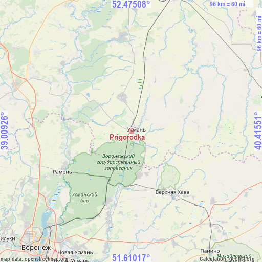
Prigorodka GPS coordinates[2]
52° 2' 40.992" North, 39° 42' 44.568" East
| Map corner | latitude | longitude |
|---|---|---|
| Upper-left | 52.47508°, | 39.00926° |
| Center: | 52.04472°, | 39.71238° |
| Lower-right: | 51.61017°, | 40.41551° |
| Map W x H: | 96.2×96.2 km | = 59.8×59.8mi |
| max Lat: | 73.50819° ⇑69% North |
| Prigorodka: | 52.04472° |
| min Lat: | ⇓31% South 41.28413° |
| min Long | Prigorodka | max Long |
| -179.12198° | 39.71238° | 179.35046° |
| W 31%⇐ | ⇒69% E |
Elevation
Elevation of Prigorodka is 154 m = 505 ft, and this is 48.6 m = 159 ft below average elevation for this country.
| Max E: |
2518 m = 8261 ft | 46.1% |
| Avg. | 202.6 m = 665 ft | |
| Prigorodka | 154 m = 505 ft | |
Min E: |
-28 m = -92 ft | 53.9% |
See also: Russia elevation on elevation.city.
Geographical zone
Prigorodka is located in North temperate zone (between Tropic of Cancer and the Arctic Circle). Distance of this North polar circle is 1614.3 km =1003.1 mi to North.| Distance of | km | miles | from Prigorodka |
|---|---|---|---|
| North Pole | 4220.2 | 2622.3 | to North |
| Arctic Circle | 1614.3 | 1003.1 | to North |
| Tropic Cancer | 3180.9 | 1976.5 | to South |
| Equator | 5786.8 | 3595.7 | to South |


Nearby cities:
15 places around Prigorodka: (largest is in red/bold)
• Borinskoye
51.4 km =31.9 mi,  333°
333°
• Khlevnoye
45.5 km =28.3 mi,  291°
291°
• Krasnolesnyy
20.1 km =12.5 mi,  205°
205°
• Novaya Usman’
49.4 km =30.7 mi,  204°
204°
• Novozhivotinnoye
41.1 km =25.5 mi,  244°
244°
• Orlovo
33.4 km =20.8 mi,  194°
194°
• Pereleshino
45 km =28 mi,  139°
139°
• Pereleshinskiy
49.4 km =30.7 mi, 137°
• Podgornoye
51.7 km =32.1 mi,  228°
228°
• Ramon’
29.5 km =18.3 mi, 240°
• Somovo
41.3 km =25.7 mi,  215°
215°
• Uglyanets
26.3 km =16.3 mi, 197°
• Usman’
1.1 km =0.7 mi,  79°
79°
• Verkhnyaya Khava
27.6 km =17.1 mi,  145°
145°
• Volya
33.3 km =20.7 mi, 200°
Sources, notices
• [Note1] Compared only with cities in Russia existing in our database
• [Src1] Map data: © OpenStreetMap contributors (CC-BY-SA)
• [Src2] Other city data from geonames.org with taken over terms of usage.
• [Src3] Geographical zone / Annual Mean Temperature by Robert A. Rohde @ Wikipedia
