Pereleshinskiy geodata
Pereleshinskiy (Voronezj) is a populated place; located in Russia in Europe/Moscow (GMT+3) time zone. With population of 3,257 people, there are 3562 cities with bigger population in this country. Compared to other cities in Russia, 71.1% of cities are located further ↑North; 66.5% of cities are located further →East and 57.2% of cities have lower elevation than Pereleshinskiy. Note1


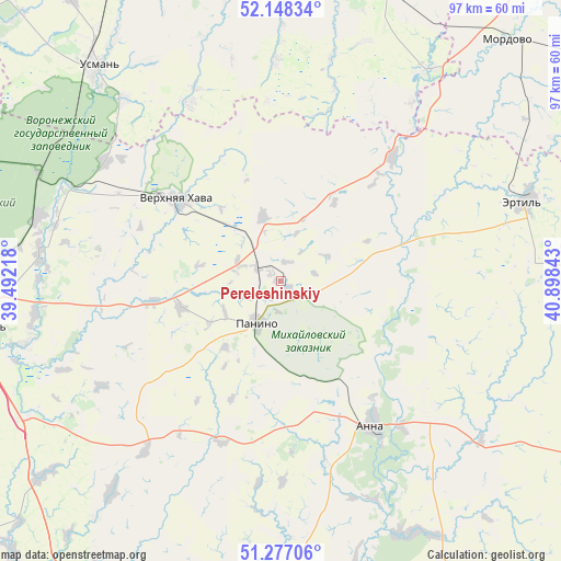
Pereleshinskiy GPS coordinates[2]
51° 42' 53.28" North, 40° 11' 43.08" East
| Map corner | latitude | longitude |
|---|---|---|
| Upper-left | 52.14834°, | 39.49218° |
| Center: | 51.7148°, | 40.1953° |
| Lower-right: | 51.27706°, | 40.89843° |
| Map W x H: | 96.9×96.9 km | = 60.2×60.2mi |
| max Lat: | 73.50819° ⇑71.1% North |
| Pereleshinskiy: | 51.7148° |
| min Lat: | ⇓28.9% South 41.28413° |
| min Long | Pereleshinskiy | max Long |
| -179.12198° | 40.1953° | 179.35046° |
| W 33.5%⇐ | ⇒66.5% E |
Elevation
Elevation of Pereleshinskiy is 161 m = 528 ft, and this is 41.6 m = 136 ft below average elevation for this country.
| Max E: |
2518 m = 8261 ft | 42.8% |
| Avg. | 202.6 m = 665 ft | |
| Pereleshinskiy | 161 m = 528 ft | |
Min E: |
-28 m = -92 ft | 57.2% |
See also: Russia elevation on elevation.city.
Geographical zone
Pereleshinskiy is located in North temperate zone (between Tropic of Cancer and the Arctic Circle). Distance of this North polar circle is 1651 km =1025.9 mi to North.| Distance of | km | miles | from Pereleshinskiy |
|---|---|---|---|
| North Pole | 4256.9 | 2645.1 | to North |
| Arctic Circle | 1651 | 1025.9 | to North |
| Tropic Cancer | 3144.2 | 1953.7 | to South |
| Equator | 5750.1 | 3572.9 | to South |


Nearby cities:
15 places around Pereleshinskiy: (largest is in red/bold)
• Anna
30.3 km =18.8 mi,  147°
147°
• Ertil’
44.2 km =27.5 mi,  71°
71°
• Kashirskoye
52 km =32.3 mi,  230°
230°
• Krasnolesnyy
45.7 km =28.4 mi,  293°
293°
• Orlovo
42.1 km =26.2 mi,  275°
275°
• Panino
8.7 km =5.4 mi,  208°
208°
• Pereleshino
4.6 km =2.9 mi,  303°
303°
• Podkletnoye
52.4 km =32.6 mi,  254°
254°
• Prigorodka
49.4 km =30.7 mi,  317°
317°
• Sadovoye
29.4 km =18.3 mi,  133°
133°
• Uglyanets
42.8 km =26.6 mi, 285°
• Usman’
48.9 km =30.4 mi, 319°
• Verkhnyaya Khava
22.4 km =13.9 mi,  308°
308°
• Verkhnyaya Tishanka
49.3 km =30.6 mi, 151°
• Volya
45.4 km =28.2 mi, 277°
Sources, notices
• [Note1] Compared only with cities in Russia existing in our database
• [Src1] Map data: © OpenStreetMap contributors (CC-BY-SA)
• [Src2] Other city data from geonames.org with taken over terms of usage.
• [Src3] Geographical zone / Annual Mean Temperature by Robert A. Rohde @ Wikipedia
