Khlevnoye geodata
Khlevnoye (Lipetsk Oblast) is a populated place; located in Russia in Europe/Moscow (GMT+3) time zone. With population of 6,150 people, there are 2216 cities with bigger population in this country. Compared to other cities in Russia, 68% of cities are located further ↑North; 71.7% of cities are located further →East and 51.9% of cities have lower elevation than Khlevnoye. Note1


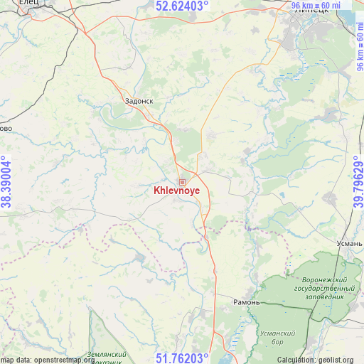
Khlevnoye GPS coordinates[2]
52° 11' 42.432" North, 39° 5' 35.376" East
| Map corner | latitude | longitude |
|---|---|---|
| Upper-left | 52.62403°, | 38.39004° |
| Center: | 52.19512°, | 39.09316° |
| Lower-right: | 51.76203°, | 39.79629° |
| Map W x H: | 95.8×95.8 km | = 59.5×59.5mi |
| max Lat: | 73.50819° ⇑68% North |
| Khlevnoye: | 52.19512° |
| min Lat: | ⇓32% South 41.28413° |
| min Long | Khlevnoye | max Long |
| -179.12198° | 39.09316° | 179.35046° |
| W 28.3%⇐ | ⇒71.7% E |
Elevation
Elevation of Khlevnoye is 149 m = 489 ft, and this is 53.6 m = 176 ft below average elevation for this country.
| Max E: |
2518 m = 8261 ft | 48.1% |
| Avg. | 202.6 m = 665 ft | |
| Khlevnoye | 149 m = 489 ft | |
Min E: |
-28 m = -92 ft | 51.9% |
See also: Russia elevation on elevation.city.
Geographical zone
Khlevnoye is located in North temperate zone (between Tropic of Cancer and the Arctic Circle). Distance of this North polar circle is 1597.6 km =992.7 mi to North.| Distance of | km | miles | from Khlevnoye |
|---|---|---|---|
| North Pole | 4203.5 | 2611.9 | to North |
| Arctic Circle | 1597.6 | 992.7 | to North |
| Tropic Cancer | 3197.6 | 1986.9 | to South |
| Equator | 5803.6 | 3606.2 | to South |


Nearby cities:
15 places around Khlevnoye: (largest is in red/bold)
• Borinskoye
34.7 km =21.6 mi,  32°
32°
• Dolgorukovo
52.7 km =32.7 mi,  285°
285°
• Donskoye
47.6 km =29.6 mi,  350°
350°
• Krasnolesnyy
48.6 km =30.2 mi,  135°
135°
• Novozhivotinnoye
34.6 km =21.5 mi,  171°
171°
• Podgornoye
51.3 km =31.9 mi,  175°
175°
• Prigorodka
45.5 km =28.3 mi,  111°
111°
• Ramon’
35.2 km =21.9 mi,  151°
151°
• Somovo
53.9 km =33.5 mi,  159°
159°
• Syrskoye
50.3 km =31.3 mi, 32°
• Terbuny
55.5 km =34.5 mi,  264°
264°
• Uglyanets
54.2 km =33.7 mi, 140°
• Usman’
46.4 km =28.8 mi, 110°
• Zadonsk
24.5 km =15.2 mi,  332°
332°
• Zemlyansk
40.6 km =25.2 mi,  217°
217°
Sources, notices
• [Note1] Compared only with cities in Russia existing in our database
• [Src1] Map data: © OpenStreetMap contributors (CC-BY-SA)
• [Src2] Other city data from geonames.org with taken over terms of usage.
• [Src3] Geographical zone / Annual Mean Temperature by Robert A. Rohde @ Wikipedia
