Novyy Rogachik geodata
Novyy Rogachik (Volgograd Oblast) is a populated place; located in Russia in Europe/Volgograd (GMT+3) time zone. With population of 7,575 people, there are 1891 cities with bigger population in this country. Compared to other cities in Russia, 79.5% of cities are located further ↑North; 52.7% of cities are located further →East and 82.8% of cities have higher elevation than Novyy Rogachik. Note1


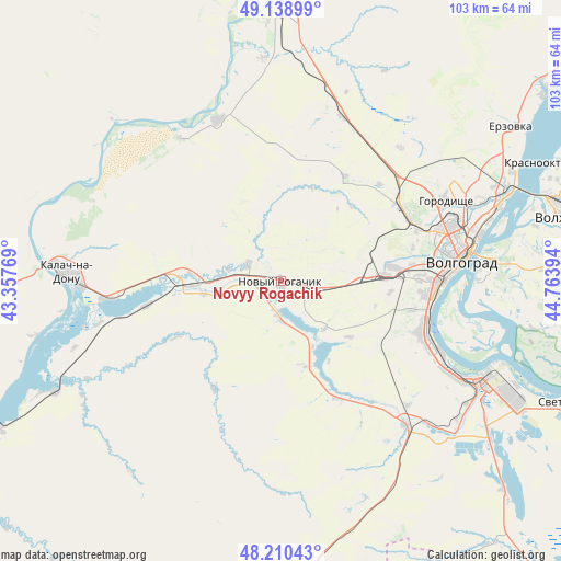
Novyy Rogachik GPS coordinates[2]
48° 40' 36.66" North, 44° 3' 38.916" East
| Map corner | latitude | longitude |
|---|---|---|
| Upper-left | 49.13899°, | 43.35769° |
| Center: | 48.67685°, | 44.06081° |
| Lower-right: | 48.21043°, | 44.76394° |
| Map W x H: | 103.2×103.2 km | = 64.1×64.1mi |
| max Lat: | 73.50819° ⇑79.5% North |
| Novyy Rogachik: | 48.67685° |
| min Lat: | ⇓20.5% South 41.28413° |
| min Long | Novyy Rogachik | max Long |
| -179.12198° | 44.06081° | 179.35046° |
| W 47.3%⇐ | ⇒52.7% E |
Elevation
Elevation of Novyy Rogachik is 59 m = 194 ft, and this is 143.6 m = 471 ft below average elevation for this country.
| Max E: |
2518 m = 8261 ft | 82.8% |
| Avg. | 202.6 m = 665 ft | |
| Novyy Rogachik | 59 m = 194 ft | |
Min E: |
-28 m = -92 ft | 17.2% |
See also: Russia elevation on elevation.city.
Geographical zone
Novyy Rogachik is located in North temperate zone (between Tropic of Cancer and the Arctic Circle). Distance of this North polar circle is 1988.8 km =1235.8 mi to North.| Distance of | km | miles | from Novyy Rogachik |
|---|---|---|---|
| North Pole | 4594.7 | 2855 | to North |
| Arctic Circle | 1988.8 | 1235.8 | to North |
| Tropic Cancer | 2806.4 | 1743.8 | to South |
| Equator | 5412.4 | 3363.1 | to South |


Nearby cities:
15 places around Novyy Rogachik: (largest is in red/bold)
• Bereslavka
5.8 km =3.6 mi,  191°
191°
• Dubovka
70.4 km =43.7 mi,  52°
52°
• Gorodishche
33.5 km =20.8 mi,  64°
64°
• Gumrak
26.4 km =16.4 mi, 63°
• Ilovlya
69.9 km =43.4 mi,  355°
355°
• Kalach-na-Donu
39.3 km =24.4 mi,  272°
272°
• Krasnoslobodsk
38 km =23.6 mi,  84°
84°
• Nizhniy Chir
80 km =49.7 mi,  243°
243°
• Oktyabr’skiy
19 km =11.8 mi,  262°
262°
• Srednyaya Akhtuba
59.3 km =36.8 mi,  86°
86°
• Svetlyy Yar
57.5 km =35.7 mi,  112°
112°
• Vodstroy
40.8 km =25.4 mi, 63°
• Volgograd
32.7 km =20.3 mi, 81°
• Volzhskiy
54.1 km =33.6 mi, 77°
• Zaplavnoye
70.7 km =43.9 mi, 87°
Sources, notices
• [Note1] Compared only with cities in Russia existing in our database
• [Src1] Map data: © OpenStreetMap contributors (CC-BY-SA)
• [Src2] Other city data from geonames.org with taken over terms of usage.
• [Src3] Geographical zone / Annual Mean Temperature by Robert A. Rohde @ Wikipedia
