Novokuybyshevsk geodata
Novokuybyshevsk (Samara Oblast) is a populated place; located in Russia in Europe/Samara (GMT+4) time zone. With population of 111,800 people, there are 181 cities with bigger population in this country. Compared to other cities in Russia, 62.3% of cities are located further ↑North; 61.8% of cities are located further ←West and 66.6% of cities have higher elevation than Novokuybyshevsk. Note1


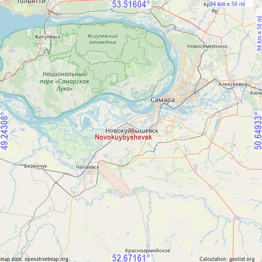
Novokuybyshevsk GPS coordinates[2]
53° 5' 45.24" North, 49° 56' 46.32" East
| Map corner | latitude | longitude |
|---|---|---|
| Upper-left | 53.51604°, | 49.24308° |
| Center: | 53.0959°, | 49.9462° |
| Lower-right: | 52.67161°, | 50.64933° |
| Map W x H: | 93.9×93.9 km | = 58.3×58.3mi |
| max Lat: | 73.50819° ⇑62.3% North |
| Novokuybyshevsk: | 53.0959° |
| min Lat: | ⇓37.7% South 41.28413° |
| min Long | Novokuybyshevsk | max Long |
| -179.12198° | 49.9462° | 179.35046° |
| W 61.8%⇐ | ⇒38.2% E |
Elevation
Elevation of Novokuybyshevsk is 110 m = 361 ft, and this is 92.6 m = 304 ft below average elevation for this country.
| Max E: |
2518 m = 8261 ft | 66.6% |
| Avg. | 202.6 m = 665 ft | |
| Novokuybyshevsk | 110 m = 361 ft | |
Min E: |
-28 m = -92 ft | 33.4% |
See also: Novokuybyshevsk elevation on elevation.city.
Geographical zone
Novokuybyshevsk is located in North temperate zone (between Tropic of Cancer and the Arctic Circle). Distance of this North polar circle is 1497.5 km =930.5 mi to North.| Distance of | km | miles | from Novokuybyshevsk |
|---|---|---|---|
| North Pole | 4103.4 | 2549.7 | to North |
| Arctic Circle | 1497.5 | 930.5 | to North |
| Tropic Cancer | 3297.8 | 2049.2 | to South |
| Equator | 5903.7 | 3668.4 | to South |


Nearby cities:
15 places around Novokuybyshevsk: (largest is in red/bold)
• Bakhilovo
39.7 km =24.7 mi,  328°
328°
• Bezenchuk
36.6 km =22.7 mi,  249°
249°
• Bogatyr’
37.1 km =23.1 mi,  359°
359°
• Chapayevsk
20.7 km =12.9 mi,  230°
230°
• Dubovyy Umët
26.3 km =16.3 mi,  120°
120°
• Krasnoarmeyskoye
42.2 km =26.2 mi,  172°
172°
• Novosemeykino
40.9 km =25.4 mi,  41°
41°
• Osinki
40.4 km =25.1 mi, 225°
• Petra-Dubrava
35.7 km =22.2 mi,  51°
51°
• Roschinskiy
37.1 km =23.1 mi,  97°
97°
• Rozhdestveno
17.5 km =10.9 mi,  25°
25°
• Samara
17.9 km =11.1 mi, 49°
• Smyshlyayevka
33.6 km =20.9 mi,  61°
61°
• Volzhskiy
38.9 km =24.2 mi,  17°
17°
• Zol’noye
39.7 km =24.7 mi,  345°
345°
In other languages:
- In Spanish: Novokúibyshevsk
- In France: Novokouïbychevsk
- In German: Nowokuibyschewsk
- In Italian: Novokujbyševsk
- In Russian: Новокуйбышевск
- In Chinese: 新古比雪夫斯克
Sources, notices
• [Note1] Compared only with cities in Russia existing in our database
• [Src1] Map data: © OpenStreetMap contributors (CC-BY-SA)
• [Src2] Other city data from geonames.org with taken over terms of usage.
• [Src3] Geographical zone / Annual Mean Temperature by Robert A. Rohde @ Wikipedia
