Morki geodata
Morki (Mariy-El Republic) is a populated place; located in Russia in Europe/Moscow (GMT+3) time zone. With population of 9,568 people, there are 1577 cities with bigger population in this country. Compared to other cities in Russia, 71.9% of cities are located further ↓South; 60.8% of cities are located further ←West and 68.2% of cities have higher elevation than Morki. Note1


Morki GPS coordinates[2]
56° 25' 49.008" North, 48° 59' 40.992" East
| Map corner | latitude | longitude |
|---|---|---|
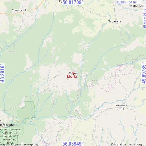
| Upper-left | 56.81709°, | 48.2916° |
| Center: | 56.43028°, | 48.99472° |
| Lower-right: | 56.03949°, | 49.69785° |
| Map W x H: | 86.5×86.5 km | = 53.7×53.7mi |
| max Lat: | 73.50819° ⇑28.1% North |
| Morki: | 56.43028° |
| min Lat: | ⇓71.9% South 41.28413° |
| min Long | Morki | max Long |
| -179.12198° | 48.99472° | 179.35046° |
| W 60.8%⇐ | ⇒39.2% E |
Elevation
Elevation of Morki is 107 m = 351 ft, and this is 95.6 m = 314 ft below average elevation for this country.
| Max E: |
2518 m = 8261 ft | 68.2% |
| Avg. | 202.6 m = 665 ft | |
| Morki | 107 m = 351 ft | |
Min E: |
-28 m = -92 ft | 31.8% |
See also: Russia elevation on elevation.city.
Geographical zone
Morki is located in North temperate zone (between Tropic of Cancer and the Arctic Circle). Distance of this North polar circle is 1126.7 km =700.1 mi to North.| Distance of | km | miles | from Morki |
|---|---|---|---|
| North Pole | 3732.6 | 2319.3 | to North |
| Arctic Circle | 1126.7 | 700.1 | to North |
| Tropic Cancer | 3668.5 | 2279.5 | to South |
| Equator | 6274.5 | 3898.8 | to South |


Nearby cities:
15 places around Morki: (largest is in red/bold)
• Aysha
66.2 km =41.1 mi,  199°
199°
• Krasnogorskiy
51.6 km =32.1 mi,  233°
233°
• Kuzhener
42.6 km =26.5 mi,  353°
353°
• Mari-Turek
55.5 km =34.5 mi,  43°
43°
• Mariyets
52.6 km =32.7 mi,  79°
79°
• Mochalishche
40.9 km =25.4 mi,  254°
254°
• Osinovo
61.5 km =38.2 mi,  186°
186°
• Paran’ga
39.5 km =24.5 mi, 39°
• Pomary
65 km =40.4 mi,  217°
217°
• Privolzhskiy
63.3 km =39.3 mi,  214°
214°
• Sernur
56.8 km =35.3 mi,  9°
9°
• Sovetskiy
48.4 km =30.1 mi,  318°
318°
• Surok
53.7 km =33.4 mi,  271°
271°
• Suslonger
47.4 km =29.5 mi, 254°
• Vysokaya Gora
60.6 km =37.7 mi,  161°
161°
Sources, notices
• [Note1] Compared only with cities in Russia existing in our database
• [Src1] Map data: © OpenStreetMap contributors (CC-BY-SA)
• [Src2] Other city data from geonames.org with taken over terms of usage.
• [Src3] Geographical zone / Annual Mean Temperature by Robert A. Rohde @ Wikipedia
