Mokrous geodata
Mokrous (Saratovskaya Oblast) is a populated place; located in Russia in Europe/Saratov (GMT+4) time zone. With population of 6,738 people, there are 2063 cities with bigger population in this country. Compared to other cities in Russia, 73.7% of cities are located further ↑North; 57.4% of cities are located further ←West and 69.3% of cities have higher elevation than Mokrous. Note1


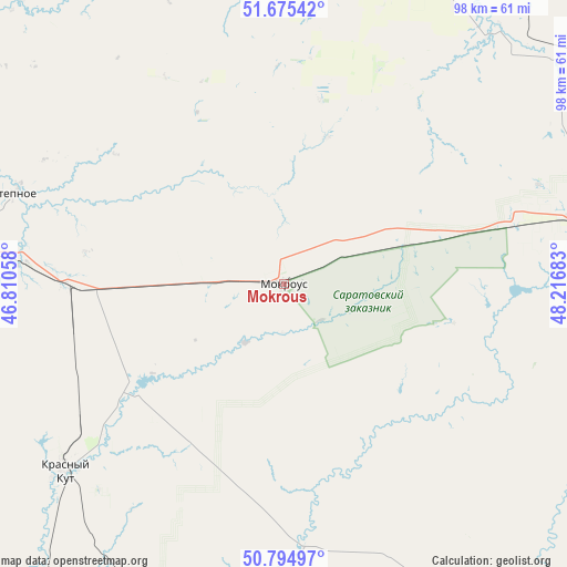
Mokrous GPS coordinates[2]
51° 14' 14.28" North, 47° 30' 49.32" East
| Map corner | latitude | longitude |
|---|---|---|
| Upper-left | 51.67542°, | 46.81058° |
| Center: | 51.2373°, | 47.5137° |
| Lower-right: | 50.79497°, | 48.21683° |
| Map W x H: | 97.9×97.9 km | = 60.8×60.8mi |
| max Lat: | 73.50819° ⇑73.7% North |
| Mokrous: | 51.2373° |
| min Lat: | ⇓26.3% South 41.28413° |
| min Long | Mokrous | max Long |
| -179.12198° | 47.5137° | 179.35046° |
| W 57.4%⇐ | ⇒42.6% E |
Elevation
Elevation of Mokrous is 104 m = 341 ft, and this is 98.6 m = 323 ft below average elevation for this country.
| Max E: |
2518 m = 8261 ft | 69.3% |
| Avg. | 202.6 m = 665 ft | |
| Mokrous | 104 m = 341 ft | |
Min E: |
-28 m = -92 ft | 30.7% |
See also: Russia elevation on elevation.city.
Geographical zone
Mokrous is located in North temperate zone (between Tropic of Cancer and the Arctic Circle). Distance of this North polar circle is 1704.1 km =1058.9 mi to North.| Distance of | km | miles | from Mokrous |
|---|---|---|---|
| North Pole | 4310 | 2678.1 | to North |
| Arctic Circle | 1704.1 | 1058.9 | to North |
| Tropic Cancer | 3091.1 | 1920.7 | to South |
| Equator | 5697.1 | 3540 | to South |


Nearby cities:
15 places around Mokrous: (largest is in red/bold)
• Balakovo
90.1 km =56 mi,  12°
12°
• Dergachi
87.2 km =54.2 mi,  90°
90°
• Kormëzhka
81.5 km =50.6 mi,  25°
25°
• Krasnyy Kut
49.8 km =30.9 mi,  230°
230°
• Krasnyy Yar
87.3 km =54.2 mi,  299°
299°
• Marks
74.7 km =46.4 mi,  314°
314°
• Piterka
62.1 km =38.6 mi,  184°
184°
• Podlesnoye
73.2 km =45.5 mi,  331°
331°
• Privolzhskoye
74.5 km =46.3 mi, 312°
• Pushkino
37.6 km =23.4 mi,  269°
269°
• Sovetskoye
58.2 km =36.2 mi,  293°
293°
• Stepnoye
48.8 km =30.3 mi, 288°
• Vol’sk
90.3 km =56.1 mi,  354°
354°
• Voskresenskoye
76.6 km =47.6 mi, 328°
• Yershov
54.5 km =33.9 mi,  76°
76°
Sources, notices
• [Note1] Compared only with cities in Russia existing in our database
• [Src1] Map data: © OpenStreetMap contributors (CC-BY-SA)
• [Src2] Other city data from geonames.org with taken over terms of usage.
• [Src3] Geographical zone / Annual Mean Temperature by Robert A. Rohde @ Wikipedia
