Dergachi geodata
Dergachi (Saratovskaya Oblast) is a populated place; located in Russia in Europe/Saratov (GMT+4) time zone. With population of 9,570 people, there are 1576 cities with bigger population in this country. Compared to other cities in Russia, 73.8% of cities are located further ↑North; 60.4% of cities are located further ←West and 83.7% of cities have higher elevation than Dergachi. Note1


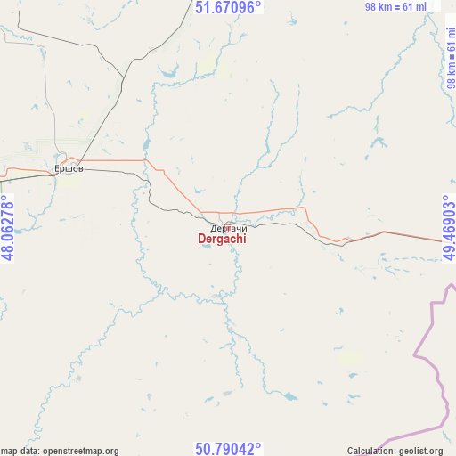
Dergachi GPS coordinates[2]
51° 13' 58.08" North, 48° 45' 57.24" East
| Map corner | latitude | longitude |
|---|---|---|
| Upper-left | 51.67096°, | 48.06278° |
| Center: | 51.2328°, | 48.7659° |
| Lower-right: | 50.79042°, | 49.46903° |
| Map W x H: | 97.9×97.9 km | = 60.8×60.8mi |
| max Lat: | 73.50819° ⇑73.8% North |
| Dergachi: | 51.2328° |
| min Lat: | ⇓26.2% South 41.28413° |
| min Long | Dergachi | max Long |
| -179.12198° | 48.7659° | 179.35046° |
| W 60.4%⇐ | ⇒39.6% E |
Elevation
Elevation of Dergachi is 54 m = 177 ft, and this is 148.6 m = 488 ft below average elevation for this country.
| Max E: |
2518 m = 8261 ft | 83.7% |
| Avg. | 202.6 m = 665 ft | |
| Dergachi | 54 m = 177 ft | |
Min E: |
-28 m = -92 ft | 16.3% |
See also: Russia elevation on elevation.city.
Geographical zone
Dergachi is located in North temperate zone (between Tropic of Cancer and the Arctic Circle). Distance of this North polar circle is 1704.6 km =1059.2 mi to North.| Distance of | km | miles | from Dergachi |
|---|---|---|---|
| North Pole | 4310.5 | 2678.4 | to North |
| Arctic Circle | 1704.6 | 1059.2 | to North |
| Tropic Cancer | 3090.6 | 1920.4 | to South |
| Equator | 5696.6 | 3539.7 | to South |


Nearby cities:
15 places around Dergachi: (largest is in red/bold)
• Aleksandrov Gay
121.5 km =75.5 mi,  186°
186°
• Alekseyevka
129.7 km =80.6 mi,  336°
336°
• Balakovo
110.7 km =68.8 mi,  322°
322°
• Gornyy
60.4 km =37.5 mi,  345°
345°
• Ivanteyevka
117.3 km =72.9 mi,  11°
11°
• Kormëzhka
90.5 km =56.2 mi,  325°
325°
• Krasnyy Kut
129.5 km =80.5 mi,  255°
255°
• Mokrous
87.2 km =54.2 mi,  270°
270°
• Novouzensk
96.5 km =60 mi,  206°
206°
• Piterka
111 km =69 mi,  236°
236°
• Pugachev
86.8 km =53.9 mi,  1°
1°
• Pushkino
124.7 km =77.5 mi, 270°
• Staryye Ozinki
63.7 km =39.6 mi,  95°
95°
• Tersa
127.2 km =79 mi, 318°
• Yershov
36.5 km =22.7 mi,  291°
291°
Sources, notices
• [Note1] Compared only with cities in Russia existing in our database
• [Src1] Map data: © OpenStreetMap contributors (CC-BY-SA)
• [Src2] Other city data from geonames.org with taken over terms of usage.
• [Src3] Geographical zone / Annual Mean Temperature by Robert A. Rohde @ Wikipedia
