Stepnoye geodata
Stepnoye (Saratovskaya Oblast) is a populated place; located in Russia in Europe/Saratov (GMT+4) time zone. With population of 14,035 people, there are 1139 cities with bigger population in this country. Compared to other cities in Russia, 73.2% of cities are located further ↑North; 55.5% of cities are located further ←West and 80.9% of cities have higher elevation than Stepnoye. Note1


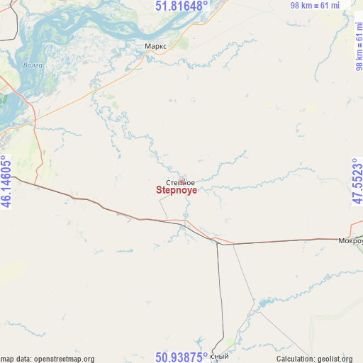
Stepnoye GPS coordinates[2]
51° 22' 46.992" North, 46° 50' 57.012" East
| Map corner | latitude | longitude |
|---|---|---|
| Upper-left | 51.81648°, | 46.14605° |
| Center: | 51.37972°, | 46.84917° |
| Lower-right: | 50.93875°, | 47.5523° |
| Map W x H: | 97.6×97.6 km | = 60.6×60.6mi |
| max Lat: | 73.50819° ⇑73.2% North |
| Stepnoye: | 51.37972° |
| min Lat: | ⇓26.8% South 41.28413° |
| min Long | Stepnoye | max Long |
| -179.12198° | 46.84917° | 179.35046° |
| W 55.5%⇐ | ⇒44.5% E |
Elevation
Elevation of Stepnoye is 68 m = 223 ft, and this is 134.6 m = 442 ft below average elevation for this country.
| Max E: |
2518 m = 8261 ft | 80.9% |
| Avg. | 202.6 m = 665 ft | |
| Stepnoye | 68 m = 223 ft | |
Min E: |
-28 m = -92 ft | 19.1% |
See also: Russia elevation on elevation.city.
Geographical zone
Stepnoye is located in North temperate zone (between Tropic of Cancer and the Arctic Circle). Distance of this North polar circle is 1688.3 km =1049.1 mi to North.| Distance of | km | miles | from Stepnoye |
|---|---|---|---|
| North Pole | 4294.2 | 2668.3 | to North |
| Arctic Circle | 1688.3 | 1049.1 | to North |
| Tropic Cancer | 3107 | 1930.6 | to South |
| Equator | 5712.9 | 3549.8 | to South |


Nearby cities:
15 places around Stepnoye: (largest is in red/bold)
• Engel’s
52.9 km =32.9 mi,  282°
282°
• Krasnyy Kut
48.5 km =30.1 mi,  170°
170°
• Krasnyy Yar
40.6 km =25.2 mi,  313°
313°
• Marks
37.5 km =23.3 mi,  349°
349°
• Mokrous
48.8 km =30.3 mi,  108°
108°
• Podlesnoye
49.8 km =30.9 mi,  12°
12°
• Privolzhskiy
55.7 km =34.6 mi,  273°
273°
• Privolzhskoye
35.8 km =22.2 mi, 345°
• Pushkino
18.3 km =11.4 mi,  151°
151°
• Saratov
60.9 km =37.8 mi,  287°
287°
• Shumeyka
46.4 km =28.8 mi,  296°
296°
• Sinodskoye
69.2 km =43 mi, 349°
• Sovetskoye
10.2 km =6.3 mi, 313°
• Voskresenskoye
49.8 km =30.9 mi, 6°
• Yelshanka
57.4 km =35.7 mi,  327°
327°
Sources, notices
• [Note1] Compared only with cities in Russia existing in our database
• [Src1] Map data: © OpenStreetMap contributors (CC-BY-SA)
• [Src2] Other city data from geonames.org with taken over terms of usage.
• [Src3] Geographical zone / Annual Mean Temperature by Robert A. Rohde @ Wikipedia
