Malyye Derbety geodata
Malyye Derbety (Kalmykiya Republic) is a populated place; located in Russia in Europe/Moscow (GMT+3) time zone. With population of 5,822 people, there are 2324 cities with bigger population in this country. Compared to other cities in Russia, 80.5% of cities are located further ↑North; 50.9% of cities are located further →East and 97.6% of cities have higher elevation than Malyye Derbety. Note1


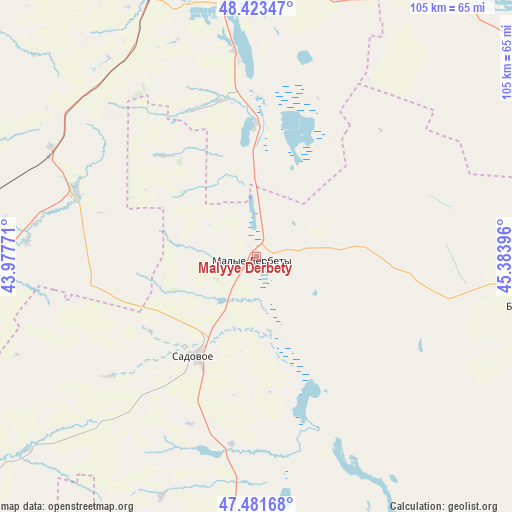
Malyye Derbety GPS coordinates[2]
47° 57' 16.992" North, 44° 40' 50.988" East
| Map corner | latitude | longitude |
|---|---|---|
| Upper-left | 48.42347°, | 43.97771° |
| Center: | 47.95472°, | 44.68083° |
| Lower-right: | 47.48168°, | 45.38396° |
| Map W x H: | 104.7×104.7 km | = 65.1×65.1mi |
| max Lat: | 73.50819° ⇑80.5% North |
| Malyye Derbety: | 47.95472° |
| min Lat: | ⇓19.5% South 41.28413° |
| min Long | Malyye Derbety | max Long |
| -179.12198° | 44.68083° | 179.35046° |
| W 49.1%⇐ | ⇒50.9% E |
Elevation
Elevation of Malyye Derbety is 6 m = 20 ft, and this is 196.6 m = 645 ft below average elevation for this country.
| Max E: |
2518 m = 8261 ft | 97.6% |
| Avg. | 202.6 m = 665 ft | |
| Malyye Derbety | 6 m = 20 ft | |
Min E: |
-28 m = -92 ft | 2.4% |
See also: Russia elevation on elevation.city.
Geographical zone
Malyye Derbety is located in North temperate zone (between Tropic of Cancer and the Arctic Circle). Distance of this North polar circle is 2069.1 km =1285.7 mi to North.| Distance of | km | miles | from Malyye Derbety |
|---|---|---|---|
| North Pole | 4675 | 2904.9 | to North |
| Arctic Circle | 2069.1 | 1285.7 | to North |
| Tropic Cancer | 2726.1 | 1693.9 | to South |
| Equator | 5332.1 | 3313.2 | to South |


Nearby cities:
15 places around Malyye Derbety: (largest is in red/bold)
• Bereslavka
88.2 km =54.8 mi,  327°
327°
• Gorodishche
95.7 km =59.5 mi,  350°
350°
• Gumrak
94.6 km =58.8 mi, 346°
• Krasnoslobodsk
84 km =52.2 mi, 354°
• Leninsk
91.5 km =56.9 mi,  24°
24°
• Novyy Rogachik
92.5 km =57.5 mi, 330°
• Oktyabr’skiy
101.3 km =62.9 mi,  320°
320°
• Sadovoye
23.1 km =14.4 mi,  211°
211°
• Sovetskoye
72.8 km =45.2 mi,  189°
189°
• Srednyaya Akhtuba
85.1 km =52.9 mi,  9°
9°
• Svetlyy Yar
58.3 km =36.2 mi, 7°
• Vodstroy
99 km =61.5 mi, 354°
• Volgograd
86 km =53.4 mi, 351°
• Volzhskiy
92.7 km =57.6 mi,  4°
4°
• Zaplavnoye
87.2 km =54.2 mi, 16°
Sources, notices
• [Note1] Compared only with cities in Russia existing in our database
• [Src1] Map data: © OpenStreetMap contributors (CC-BY-SA)
• [Src2] Other city data from geonames.org with taken over terms of usage.
• [Src3] Geographical zone / Annual Mean Temperature by Robert A. Rohde @ Wikipedia
