Lyubim geodata
Lyubim (Jaroslavl) is a populated place; located in Russia in Europe/Moscow (GMT+3) time zone. With population of 6,057 people, there are 2239 cities with bigger population in this country. Compared to other cities in Russia, 84.1% of cities are located further ↓South; 64.2% of cities are located further →East and 68.2% of cities have higher elevation than Lyubim. Note1


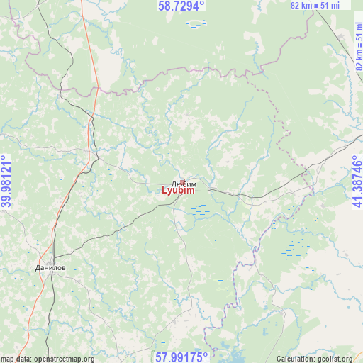
Lyubim GPS coordinates[2]
58° 21' 45" North, 40° 41' 3.588" East
| Map corner | latitude | longitude |
|---|---|---|
| Upper-left | 58.7294°, | 39.98121° |
| Center: | 58.3625°, | 40.68433° |
| Lower-right: | 57.99175°, | 41.38746° |
| Map W x H: | 82×82 km | = 51×51mi |
| max Lat: | 73.50819° ⇑15.9% North |
| Lyubim: | 58.3625° |
| min Lat: | ⇓84.1% South 41.28413° |
| min Long | Lyubim | max Long |
| -179.12198° | 40.68433° | 179.35046° |
| W 35.8%⇐ | ⇒64.2% E |
Elevation
Elevation of Lyubim is 107 m = 351 ft, and this is 95.6 m = 314 ft below average elevation for this country.
| Max E: |
2518 m = 8261 ft | 68.2% |
| Avg. | 202.6 m = 665 ft | |
| Lyubim | 107 m = 351 ft | |
Min E: |
-28 m = -92 ft | 31.8% |
See also: Russia elevation on elevation.city.
Geographical zone
Lyubim is located in North temperate zone (between Tropic of Cancer and the Arctic Circle). Distance of this North polar circle is 911.9 km =566.6 mi to North.| Distance of | km | miles | from Lyubim |
|---|---|---|---|
| North Pole | 3517.8 | 2185.9 | to North |
| Arctic Circle | 911.9 | 566.6 | to North |
| Tropic Cancer | 3883.4 | 2413 | to South |
| Equator | 6489.3 | 4032.3 | to South |


Nearby cities:
15 places around Lyubim: (largest is in red/bold)
• Buy
51.4 km =31.9 mi,  75°
75°
• Chistyye Bory
55 km =34.2 mi,  89°
89°
• Danilov
35.5 km =22.1 mi,  237°
237°
• Gryazovets
62.7 km =39 mi,  336°
336°
• Kostroma
67.8 km =42.1 mi,  167°
167°
• Krasnyy Profintern
70.3 km =43.7 mi,  192°
192°
• Kukoboy
58.4 km =36.3 mi,  310°
310°
• Levashevo
80.4 km =50 mi, 186°
• Nekrasovskoye
78.5 km =48.8 mi, 193°
• Oktyabr’skiy
71.2 km =44.2 mi,  164°
164°
• Prechistoye
21.1 km =13.1 mi,  287°
287°
• Sudislavl’
80.5 km =50 mi,  131°
131°
• Susanino
58.3 km =36.2 mi,  114°
114°
• Tutayev
85.6 km =53.2 mi,  231°
231°
• Vokhtoga
54.3 km =33.7 mi,  23°
23°
Sources, notices
• [Note1] Compared only with cities in Russia existing in our database
• [Src1] Map data: © OpenStreetMap contributors (CC-BY-SA)
• [Src2] Other city data from geonames.org with taken over terms of usage.
• [Src3] Geographical zone / Annual Mean Temperature by Robert A. Rohde @ Wikipedia
