Oktyabr’skiy geodata
Oktyabr’skiy (Kostroma Oblast) is a seat of a second-order administrative division; located in Russia in Europe/Moscow (GMT+3) time zone. In our database, there are 4966 cities with bigger population. Compared to other cities in Russia, 81.2% of cities are located further ↓South; 63.2% of cities are located further →East and 54.2% of cities have higher elevation than Oktyabr’skiy. Note1


Oktyabr’skiy GPS coordinates[2]
57° 44' 40.416" North, 41° 0' 6.948" East
| Map corner | latitude | longitude |
|---|---|---|
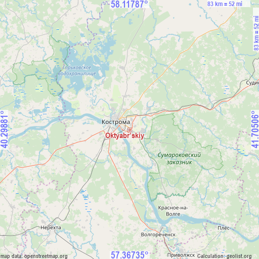
| Upper-left | 58.11787°, | 40.29881° |
| Center: | 57.74456°, | 41.00193° |
| Lower-right: | 57.36735°, | 41.70506° |
| Map W x H: | 83.5×83.4 km | = 51.9×51.8mi |
| max Lat: | 73.50819° ⇑18.8% North |
| Oktyabr’skiy: | 57.74456° |
| min Lat: | ⇓81.2% South 41.28413° |
| min Long | Oktyabr’skiy | max Long |
| -179.12198° | 41.00193° | 179.35046° |
| W 36.8%⇐ | ⇒63.2% E |
Elevation
Elevation of Oktyabr’skiy is 136 m = 446 ft, and this is 66.6 m = 219 ft below average elevation for this country.
| Max E: |
2518 m = 8261 ft | 54.2% |
| Avg. | 202.6 m = 665 ft | |
| Oktyabr’skiy | 136 m = 446 ft | |
Min E: |
-28 m = -92 ft | 45.8% |
See also: Russia elevation on elevation.city.
Geographical zone
Oktyabr’skiy is located in North temperate zone (between Tropic of Cancer and the Arctic Circle). Distance of this North polar circle is 980.6 km =609.3 mi to North.| Distance of | km | miles | from Oktyabr’skiy |
|---|---|---|---|
| North Pole | 3586.5 | 2228.5 | to North |
| Arctic Circle | 980.6 | 609.3 | to North |
| Tropic Cancer | 3814.7 | 2370.3 | to South |
| Equator | 6420.6 | 3989.6 | to South |


Nearby cities:
15 places around Oktyabr’skiy: (largest is in red/bold)
• Dulyapino
55.3 km =34.4 mi,  191°
191°
• Furmanov
55 km =34.2 mi,  173°
173°
• Kosmynino
23 km =14.3 mi,  217°
217°
• Kostroma
5.1 km =3.2 mi,  298°
298°
• Krasnoye-na-Volge
29.2 km =18.1 mi,  151°
151°
• Krasnyy Profintern
33.6 km =20.9 mi,  270°
270°
• Levashevo
30.5 km =19 mi,  248°
248°
• Nekrasovskoye
38.5 km =23.9 mi,  258°
258°
• Nerekhta
40.7 km =25.3 mi, 218°
• Plës
44.1 km =27.4 mi,  136°
136°
• Privolzhsk
43.2 km =26.8 mi,  156°
156°
• Sudislavl’
44.5 km =27.7 mi,  69°
69°
• Susanino
57 km =35.4 mi,  37°
37°
• Tunoshna
56.6 km =35.2 mi, 247°
• Volgorechensk
35.2 km =21.9 mi, 164°
Sources, notices
• [Note1] Compared only with cities in Russia existing in our database
• [Src1] Map data: © OpenStreetMap contributors (CC-BY-SA)
• [Src2] Other city data from geonames.org with taken over terms of usage.
• [Src3] Geographical zone / Annual Mean Temperature by Robert A. Rohde @ Wikipedia
