Lopatino geodata
Lopatino (Penza) is a populated place; located in Russia in Europe/Moscow (GMT+3) time zone. With population of 4,318 people, there are 2946 cities with bigger population in this country. Compared to other cities in Russia, 65.3% of cities are located further ↑North; 52.3% of cities are located further ←West and 68% of cities have lower elevation than Lopatino. Note1


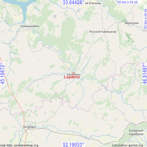
Lopatino GPS coordinates[2]
52° 37' 10.164" North, 45° 48' 42.624" East
| Map corner | latitude | longitude |
|---|---|---|
| Upper-left | 53.04428°, | 45.10872° |
| Center: | 52.61949°, | 45.81184° |
| Lower-right: | 52.19053°, | 46.51497° |
| Map W x H: | 94.9×94.9 km | = 59×59mi |
| max Lat: | 73.50819° ⇑65.3% North |
| Lopatino: | 52.61949° |
| min Lat: | ⇓34.7% South 41.28413° |
| min Long | Lopatino | max Long |
| -179.12198° | 45.81184° | 179.35046° |
| W 52.3%⇐ | ⇒47.7% E |
Elevation
Elevation of Lopatino is 191 m = 627 ft, and this is 11.6 m = 38 ft below average elevation for this country.
| Max E: |
2518 m = 8261 ft | 32% |
| Avg. | 202.6 m = 665 ft | |
| Lopatino | 191 m = 627 ft | |
Min E: |
-28 m = -92 ft | 68% |
See also: Russia elevation on elevation.city.
Geographical zone
Lopatino is located in North temperate zone (between Tropic of Cancer and the Arctic Circle). Distance of this North polar circle is 1550.4 km =963.4 mi to North.| Distance of | km | miles | from Lopatino |
|---|---|---|---|
| North Pole | 4156.3 | 2582.6 | to North |
| Arctic Circle | 1550.4 | 963.4 | to North |
| Tropic Cancer | 3244.8 | 2016.2 | to South |
| Equator | 5850.7 | 3635.5 | to South |


Nearby cities:
15 places around Lopatino: (largest is in red/bold)
• Baltay
58 km =36 mi,  107°
107°
• Bazarnyy Karabulak
56.5 km =35.1 mi,  133°
133°
• Chaadayevka
58.6 km =36.4 mi,  6°
6°
• Kanayevka
56.8 km =35.3 mi,  342°
342°
• Khvatovka
58.9 km =36.6 mi,  120°
120°
• Kondol’
55.4 km =34.4 mi,  293°
293°
• Makhalino
58.6 km =36.4 mi,  27°
27°
• Novyye Burasy
57 km =35.4 mi,  161°
161°
• Petrovsk
45 km =28 mi,  219°
219°
• Russkiy Kameshkir
32.6 km =20.3 mi, 34°
• Shemysheyka
41.4 km =25.7 mi,  317°
317°
• Srednyaya Yelyuzan’
46 km =28.6 mi, 11°
• Sursk
51.4 km =31.9 mi,  350°
350°
• Svobodnyy
49.7 km =30.9 mi, 130°
• Verkhozim
28.5 km =17.7 mi, 291°
Sources, notices
• [Note1] Compared only with cities in Russia existing in our database
• [Src1] Map data: © OpenStreetMap contributors (CC-BY-SA)
• [Src2] Other city data from geonames.org with taken over terms of usage.
• [Src3] Geographical zone / Annual Mean Temperature by Robert A. Rohde @ Wikipedia
