Petrovsk geodata
Petrovsk (Saratovskaya Oblast) is a populated place; located in Russia in Europe/Saratov (GMT+4) time zone. With population of 33,622 people, there are 595 cities with bigger population in this country. Compared to other cities in Russia, 67.3% of cities are located further ↑North; 51.1% of cities are located further ←West and 65.9% of cities have lower elevation than Petrovsk. Note1


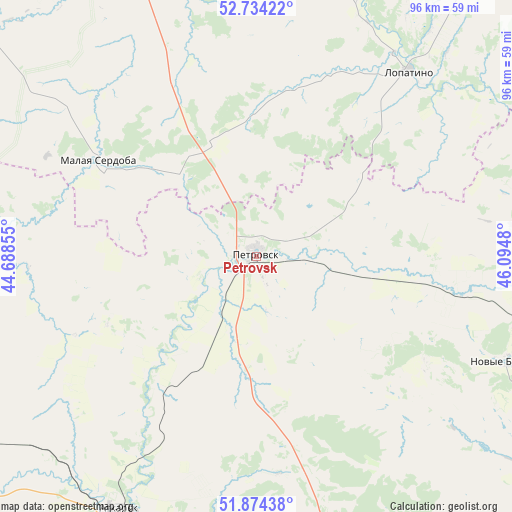
Petrovsk GPS coordinates[2]
52° 18' 23.004" North, 45° 23' 30.012" East
| Map corner | latitude | longitude |
|---|---|---|
| Upper-left | 52.73422°, | 44.68855° |
| Center: | 52.30639°, | 45.39167° |
| Lower-right: | 51.87438°, | 46.0948° |
| Map W x H: | 95.6×95.6 km | = 59.4×59.4mi |
| max Lat: | 73.50819° ⇑67.3% North |
| Petrovsk: | 52.30639° |
| min Lat: | ⇓32.7% South 41.28413° |
| min Long | Petrovsk | max Long |
| -179.12198° | 45.39167° | 179.35046° |
| W 51.1%⇐ | ⇒48.9% E |
Elevation
Elevation of Petrovsk is 184 m = 604 ft, and this is 18.6 m = 61 ft below average elevation for this country.
| Max E: |
2518 m = 8261 ft | 34.1% |
| Avg. | 202.6 m = 665 ft | |
| Petrovsk | 184 m = 604 ft | |
Min E: |
-28 m = -92 ft | 65.9% |
See also: Russia elevation on elevation.city.
Geographical zone
Petrovsk is located in North temperate zone (between Tropic of Cancer and the Arctic Circle). Distance of this North polar circle is 1585.2 km =985 mi to North.| Distance of | km | miles | from Petrovsk |
|---|---|---|---|
| North Pole | 4191.1 | 2604.2 | to North |
| Arctic Circle | 1585.2 | 985 | to North |
| Tropic Cancer | 3210 | 1994.6 | to South |
| Equator | 5815.9 | 3613.8 | to South |


Nearby cities:
15 places around Petrovsk: (largest is in red/bold)
• Atkarsk
55 km =34.2 mi,  208°
208°
• Bazarnyy Karabulak
69.7 km =43.3 mi,  93°
93°
• Khvatovka
79.7 km =49.5 mi, 86°
• Kolyshley
72.6 km =45.1 mi,  307°
307°
• Kondol’
61.3 km =38.1 mi,  338°
338°
• Lopatino
45 km =28 mi,  39°
39°
• Malaya Serdoba
34.8 km =21.6 mi,  300°
300°
• Novyye Burasy
50.2 km =31.2 mi,  112°
112°
• Russkiy Kameshkir
77.5 km =48.2 mi, 37°
• Shemysheyka
65.1 km =40.5 mi,  0°
0°
• Svetlyy
72.2 km =44.9 mi,  166°
166°
• Svobodnyy
66.6 km =41.4 mi, 87°
• Tatishchevo
72.1 km =44.8 mi, 168°
• Verkhozim
45.2 km =28.1 mi, 2°
• Yekaterinovka
76.8 km =47.7 mi,  248°
248°
Sources, notices
• [Note1] Compared only with cities in Russia existing in our database
• [Src1] Map data: © OpenStreetMap contributors (CC-BY-SA)
• [Src2] Other city data from geonames.org with taken over terms of usage.
• [Src3] Geographical zone / Annual Mean Temperature by Robert A. Rohde @ Wikipedia
