Likhoslavl’ geodata
Likhoslavl’ (Tver’ Oblast) is a populated place; located in Russia in Europe/Moscow (GMT+3) time zone. With population of 12,290 people, there are 1252 cities with bigger population in this country. Compared to other cities in Russia, 78.1% of cities are located further ↓South; 88.4% of cities are located further →East and 59.5% of cities have lower elevation than Likhoslavl’. Note1


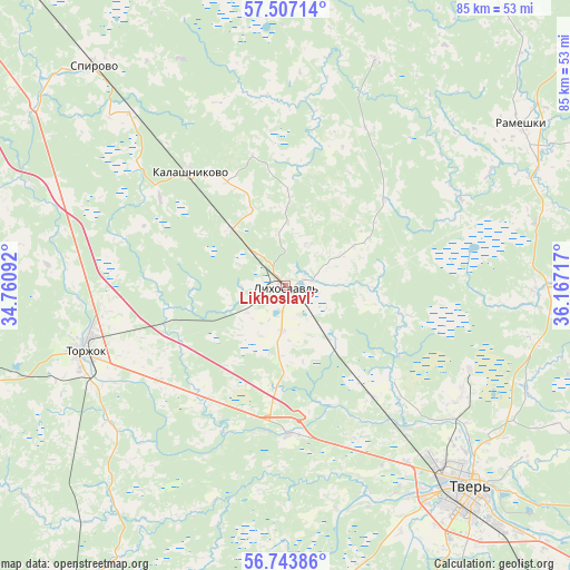
Likhoslavl’ GPS coordinates[2]
57° 7' 38.892" North, 35° 27' 50.544" East
| Map corner | latitude | longitude |
|---|---|---|
| Upper-left | 57.50714°, | 34.76092° |
| Center: | 57.12747°, | 35.46404° |
| Lower-right: | 56.74386°, | 36.16717° |
| Map W x H: | 84.9×84.9 km | = 52.8×52.8mi |
| max Lat: | 73.50819° ⇑21.9% North |
| Likhoslavl’: | 57.12747° |
| min Lat: | ⇓78.1% South 41.28413° |
| min Long | Likhoslavl’ | max Long |
| -179.12198° | 35.46404° | 179.35046° |
| W 11.6%⇐ | ⇒88.4% E |
Elevation
Elevation of Likhoslavl’ is 167 m = 548 ft, and this is 35.6 m = 117 ft below average elevation for this country.
| Max E: |
2518 m = 8261 ft | 40.5% |
| Avg. | 202.6 m = 665 ft | |
| Likhoslavl’ | 167 m = 548 ft | |
Min E: |
-28 m = -92 ft | 59.5% |
See also: Russia elevation on elevation.city.
Geographical zone
Likhoslavl’ is located in North temperate zone (between Tropic of Cancer and the Arctic Circle). Distance of this North polar circle is 1049.2 km =651.9 mi to North.| Distance of | km | miles | from Likhoslavl’ |
|---|---|---|---|
| North Pole | 3655.1 | 2271.2 | to North |
| Arctic Circle | 1049.2 | 651.9 | to North |
| Tropic Cancer | 3746.1 | 2327.7 | to South |
| Equator | 6352 | 3946.9 | to South |


Nearby cities:
15 places around Likhoslavl’: (largest is in red/bold)
• Bernovo
67.4 km =41.9 mi,  223°
223°
• Emmaus
55.2 km =34.3 mi,  134°
134°
• Gorodnya
69.9 km =43.4 mi, 132°
• Gruziny
33.1 km =20.6 mi,  229°
229°
• Izoplit
72.4 km =45 mi,  140°
140°
• Kalashnikovo
22.4 km =13.9 mi,  320°
320°
• Orsha
52.1 km =32.4 mi,  117°
117°
• Rameshki
42.5 km =26.4 mi,  55°
55°
• Sakharovo
43.6 km =27.1 mi, 125°
• Spirovo
43.7 km =27.2 mi, 317°
• Sukhoverkovo
56 km =34.8 mi,  173°
173°
• Torzhok
31.7 km =19.7 mi,  252°
252°
• Tver
39.9 km =24.8 mi, 138°
• Vasil’yevskiy Mokh
30.3 km =18.8 mi,  114°
114°
• Vydropuzhsk
45.7 km =28.4 mi,  305°
305°
Sources, notices
• [Note1] Compared only with cities in Russia existing in our database
• [Src1] Map data: © OpenStreetMap contributors (CC-BY-SA)
• [Src2] Other city data from geonames.org with taken over terms of usage.
• [Src3] Geographical zone / Annual Mean Temperature by Robert A. Rohde @ Wikipedia
