Garbolovo geodata
Garbolovo (Leningradskaya Oblast') is a populated place; located in Russia in Europe/Moscow (GMT+3) time zone. With population of 3,830 people, there are 3199 cities with bigger population in this country. Compared to other cities in Russia, 91.7% of cities are located further ↓South; 95.3% of cities are located further →East and 76.7% of cities have higher elevation than Garbolovo. Note1


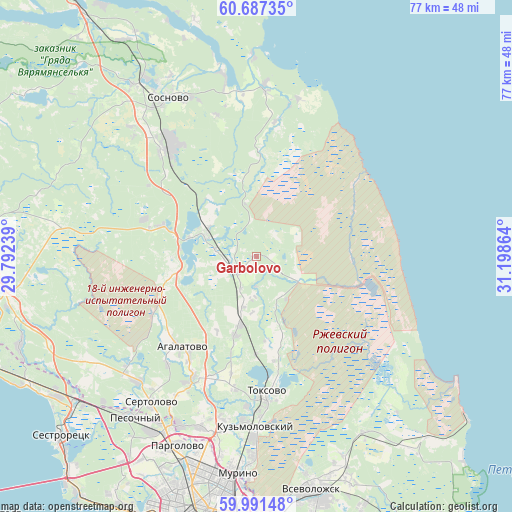
Garbolovo GPS coordinates[2]
60° 20' 28.572" North, 30° 29' 43.836" East
| Map corner | latitude | longitude |
|---|---|---|
| Upper-left | 60.68735°, | 29.79239° |
| Center: | 60.34127°, | 30.49551° |
| Lower-right: | 59.99148°, | 31.19864° |
| Map W x H: | 77.4×77.4 km | = 48.1×48.1mi |
| max Lat: | 73.50819° ⇑8.3% North |
| Garbolovo: | 60.34127° |
| min Lat: | ⇓91.7% South 41.28413° |
| min Long | Garbolovo | max Long |
| -179.12198° | 30.49551° | 179.35046° |
| W 4.7%⇐ | ⇒95.3% E |
Elevation
Elevation of Garbolovo is 82 m = 269 ft, and this is 120.6 m = 396 ft below average elevation for this country.
| Max E: |
2518 m = 8261 ft | 76.7% |
| Avg. | 202.6 m = 665 ft | |
| Garbolovo | 82 m = 269 ft | |
Min E: |
-28 m = -92 ft | 23.3% |
See also: Russia elevation on elevation.city.
Geographical zone
Garbolovo is located in North temperate zone (between Tropic of Cancer and the Arctic Circle). Distance of this North polar circle is 691.9 km =429.9 mi to North.| Distance of | km | miles | from Garbolovo |
|---|---|---|---|
| North Pole | 3297.7 | 2049.1 | to North |
| Arctic Circle | 691.9 | 429.9 | to North |
| Tropic Cancer | 4103.4 | 2549.7 | to South |
| Equator | 6709.3 | 4169 | to South |


Nearby cities:
15 places around Garbolovo: (largest is in red/bold)
• Agalatovo
18.2 km =11.3 mi,  222°
222°
• Bugry
30.6 km =19 mi,  190°
190°
• Kuyvozi
4.1 km =2.5 mi,  233°
233°
• Leskolovo
8.9 km =5.5 mi, 194°
• Levashovo
30.9 km =19.2 mi,  211°
211°
• Luppolovo
24 km =14.9 mi, 209°
• Novoye Devyatkino
30.9 km =19.2 mi,  181°
181°
• Osel’ki
15.1 km =9.4 mi, 179°
• Pesochnyy
30.4 km =18.9 mi, 217°
• Sertolovo
27.2 km =16.9 mi, 216°
• Sosnovo
28 km =17.4 mi,  326°
326°
• Toksovo
20.9 km =13 mi, 176°
• Vaskelovo
9.8 km =6.1 mi,  307°
307°
• Verkhniye Osel’ki
10.5 km =6.5 mi, 193°
• Yukki
28.2 km =17.5 mi,  204°
204°
Sources, notices
• [Note1] Compared only with cities in Russia existing in our database
• [Src1] Map data: © OpenStreetMap contributors (CC-BY-SA)
• [Src2] Other city data from geonames.org with taken over terms of usage.
• [Src3] Geographical zone / Annual Mean Temperature by Robert A. Rohde @ Wikipedia
