Knyazh’i Gory geodata
Knyazh’i Gory (Tver’ Oblast) is a populated place; located in Russia in Europe/Moscow (GMT+3) time zone. With population of 989 people, there are 4655 cities with bigger population in this country. Compared to other cities in Russia, 67.7% of cities are located further ↓South; 88.7% of cities are located further →East and 76.4% of cities have lower elevation than Knyazh’i Gory. Note1


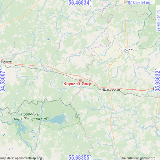
Knyazh’i Gory GPS coordinates[2]
56° 4' 40.584" North, 35° 13' 59.484" East
| Map corner | latitude | longitude |
|---|---|---|
| Upper-left | 56.46834°, | 34.53007° |
| Center: | 56.07794°, | 35.23319° |
| Lower-right: | 55.68355°, | 35.93632° |
| Map W x H: | 87.3×87.3 km | = 54.2×54.2mi |
| max Lat: | 73.50819° ⇑32.3% North |
| Knyazh’i Gory: | 56.07794° |
| min Lat: | ⇓67.7% South 41.28413° |
| min Long | Knyazh’i Gory | max Long |
| -179.12198° | 35.23319° | 179.35046° |
| W 11.3%⇐ | ⇒88.7% E |
Elevation
Elevation of Knyazh’i Gory is 223 m = 732 ft, and this is 20.4 m = 67 ft above average elevation for this country.
| Max E: |
2518 m = 8261 ft | 23.6% |
| Knyazh’i Gory | 223 m 732 ft | |
| Avg. | 202.6 m = 665 ft | |
Min E: |
-28 m = -92 ft | 76.4% |
See also: Russia elevation on elevation.city.
Geographical zone
Knyazh’i Gory is located in North temperate zone (between Tropic of Cancer and the Arctic Circle). Distance of this North polar circle is 1165.9 km =724.5 mi to North.| Distance of | km | miles | from Knyazh’i Gory |
|---|---|---|---|
| North Pole | 3771.8 | 2343.7 | to North |
| Arctic Circle | 1165.9 | 724.5 | to North |
| Tropic Cancer | 3629.4 | 2255.2 | to South |
| Equator | 6235.3 | 3874.4 | to South |


Nearby cities:
15 places around Knyazh’i Gory: (largest is in red/bold)
• Arkhangel’skoye
25.5 km =15.8 mi,  166°
166°
• Gagarin
60.2 km =37.4 mi,  194°
194°
• Kur’yanovo
31.3 km =19.4 mi,  100°
100°
• Lotoshino
30.8 km =19.1 mi,  55°
55°
• Mikulino
47.6 km =29.6 mi,  29°
29°
• Ostashëvo
46.5 km =28.9 mi,  121°
121°
• Rzhev
59.7 km =37.1 mi,  290°
290°
• Shakhovskaya
17.8 km =11.1 mi,  106°
106°
• Stantsia Staritsa
57.9 km =36 mi,  330°
330°
• Staritsa
51.2 km =31.8 mi,  338°
338°
• Sychëvo
63.2 km =39.3 mi, 102°
• Teryayevo
56.2 km =34.9 mi,  79°
79°
• Volokolamsk
46 km =28.6 mi, 96°
• Yaropolets
37.7 km =23.4 mi, 80°
• Zubtsov
41.3 km =25.7 mi, 285°
Sources, notices
• [Note1] Compared only with cities in Russia existing in our database
• [Src1] Map data: © OpenStreetMap contributors (CC-BY-SA)
• [Src2] Other city data from geonames.org with taken over terms of usage.
• [Src3] Geographical zone / Annual Mean Temperature by Robert A. Rohde @ Wikipedia
