Gagarin geodata
Gagarin (Smolensk) is a populated place; located in Russia in Europe/Moscow (GMT+3) time zone. With population of 28,879 people, there are 679 cities with bigger population in this country. Compared to other cities in Russia, 58.8% of cities are located further ↓South; 89% of cities are located further →East and 68.7% of cities have lower elevation than Gagarin. Note1


Gagarin GPS coordinates[2]
55° 33' 10.476" North, 34° 59' 43.332" East
| Map corner | latitude | longitude |
|---|---|---|
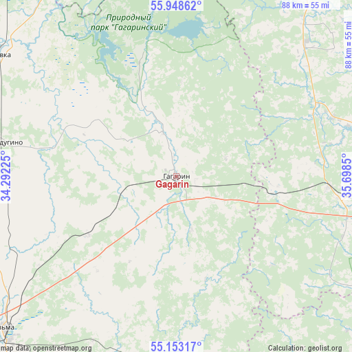
| Upper-left | 55.94862°, | 34.29225° |
| Center: | 55.55291°, | 34.99537° |
| Lower-right: | 55.15317°, | 35.6985° |
| Map W x H: | 88.4×88.4 km | = 54.9×54.9mi |
| max Lat: | 73.50819° ⇑41.2% North |
| Gagarin: | 55.55291° |
| min Lat: | ⇓58.8% South 41.28413° |
| min Long | Gagarin | max Long |
| -179.12198° | 34.99537° | 179.35046° |
| W 11%⇐ | ⇒89% E |
Elevation
Elevation of Gagarin is 193 m = 633 ft, and this is 9.6 m = 31 ft below average elevation for this country.
| Max E: |
2518 m = 8261 ft | 31.3% |
| Avg. | 202.6 m = 665 ft | |
| Gagarin | 193 m = 633 ft | |
Min E: |
-28 m = -92 ft | 68.7% |
See also: Russia elevation on elevation.city.
Geographical zone
Gagarin is located in North temperate zone (between Tropic of Cancer and the Arctic Circle). Distance of this North polar circle is 1224.3 km =760.7 mi to North.| Distance of | km | miles | from Gagarin |
|---|---|---|---|
| North Pole | 3830.2 | 2380 | to North |
| Arctic Circle | 1224.3 | 760.7 | to North |
| Tropic Cancer | 3571 | 2218.9 | to South |
| Equator | 6176.9 | 3838.1 | to South |


Nearby cities:
15 places around Gagarin: (largest is in red/bold)
• Arkhangel’skoye
39.5 km =24.5 mi,  31°
31°
• Borisovo
67.8 km =42.1 mi,  102°
102°
• Gidrouzel
59.7 km =37.1 mi,  92°
92°
• Iznoski
65.9 km =40.9 mi,  162°
162°
• Knyazh’i Gory
60.2 km =37.4 mi,  14°
14°
• Kur’yanovo
69.8 km =43.4 mi,  41°
41°
• Mozhaysk
65.2 km =40.5 mi, 94°
• Novodugino
45.5 km =28.3 mi,  280°
280°
• Ostashëvo
64.5 km =40.1 mi,  58°
58°
• Shakhovskaya
62.1 km =38.6 mi, 31°
• Sychëvka
54.4 km =33.8 mi,  303°
303°
• Tëmkino
49.4 km =30.7 mi,  178°
178°
• Uvarovka
38.5 km =23.9 mi, 94°
• Vyaz’ma
58.4 km =36.3 mi,  229°
229°
• Zubtsov
73.7 km =45.8 mi,  339°
339°
Sources, notices
• [Note1] Compared only with cities in Russia existing in our database
• [Src1] Map data: © OpenStreetMap contributors (CC-BY-SA)
• [Src2] Other city data from geonames.org with taken over terms of usage.
• [Src3] Geographical zone / Annual Mean Temperature by Robert A. Rohde @ Wikipedia
