Kharitonovo geodata
Kharitonovo (Arkhangelskaya) is a populated place; located in Russia in Europe/Moscow (GMT+3) time zone. With population of 1,402 people, there are 4428 cities with bigger population in this country. Compared to other cities in Russia, 93.9% of cities are located further ↓South; 57.4% of cities are located further ←West and 66.6% of cities have higher elevation than Kharitonovo. Note1


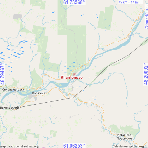
Kharitonovo GPS coordinates[2]
61° 24' 3.312" North, 47° 29' 52.044" East
| Map corner | latitude | longitude |
|---|---|---|
| Upper-left | 61.73568°, | 46.79467° |
| Center: | 61.40092°, | 47.49779° |
| Lower-right: | 61.06253°, | 48.20092° |
| Map W x H: | 74.8×74.8 km | = 46.5×46.5mi |
| max Lat: | 73.50819° ⇑6.1% North |
| Kharitonovo: | 61.40092° |
| min Lat: | ⇓93.9% South 41.28413° |
| min Long | Kharitonovo | max Long |
| -179.12198° | 47.49779° | 179.35046° |
| W 57.4%⇐ | ⇒42.6% E |
Elevation
Elevation of Kharitonovo is 110 m = 361 ft, and this is 92.6 m = 304 ft below average elevation for this country.
| Max E: |
2518 m = 8261 ft | 66.6% |
| Avg. | 202.6 m = 665 ft | |
| Kharitonovo | 110 m = 361 ft | |
Min E: |
-28 m = -92 ft | 33.4% |
See also: Russia elevation on elevation.city.
Geographical zone
Kharitonovo is located in North temperate zone (between Tropic of Cancer and the Arctic Circle). Distance of this North polar circle is 574 km =356.7 mi to North.| Distance of | km | miles | from Kharitonovo |
|---|---|---|---|
| North Pole | 3179.9 | 1975.9 | to North |
| Arctic Circle | 574 | 356.7 | to North |
| Tropic Cancer | 4221.2 | 2622.9 | to South |
| Equator | 6827.1 | 4242.2 | to South |


Nearby cities:
15 places around Kharitonovo: (largest is in red/bold)
• Cheremushskiy
18.9 km =11.7 mi,  221°
221°
• Il’insko-Podomskoye
40.9 km =25.4 mi,  141°
141°
• Khristoforovo
57.3 km =35.6 mi,  193°
193°
• Koryazhma
20 km =12.4 mi,  241°
241°
• Kotlas
48 km =29.8 mi,  250°
250°
• Krasavino
73 km =45.4 mi,  228°
228°
• Krasnoborsk
84.9 km =52.8 mi,  282°
282°
• Lal’sk
73.5 km =45.7 mi,  176°
176°
• Luza
86.7 km =53.9 mi, 188°
• Privodino
64.4 km =40 mi, 235°
• Shipitsyno
53.8 km =33.4 mi,  255°
255°
• Sol’vychegodsk
32 km =19.9 mi, 255°
• Udimskiy
89.4 km =55.6 mi, 251°
• Urdoma
67.8 km =42.1 mi,  54°
54°
• Vychegodskiy
36.3 km =22.6 mi, 241°
Sources, notices
• [Note1] Compared only with cities in Russia existing in our database
• [Src1] Map data: © OpenStreetMap contributors (CC-BY-SA)
• [Src2] Other city data from geonames.org with taken over terms of usage.
• [Src3] Geographical zone / Annual Mean Temperature by Robert A. Rohde @ Wikipedia
