Il’insko-Podomskoye geodata
Il’insko-Podomskoye (Arkhangelskaya) is a populated place; located in Russia in Europe/Moscow (GMT+3) time zone. With population of 2,973 people, there are 3794 cities with bigger population in this country. Compared to other cities in Russia, 93.2% of cities are located further ↓South; 58.8% of cities are located further ←West and 70.2% of cities have higher elevation than Il’insko-Podomskoye. Note1


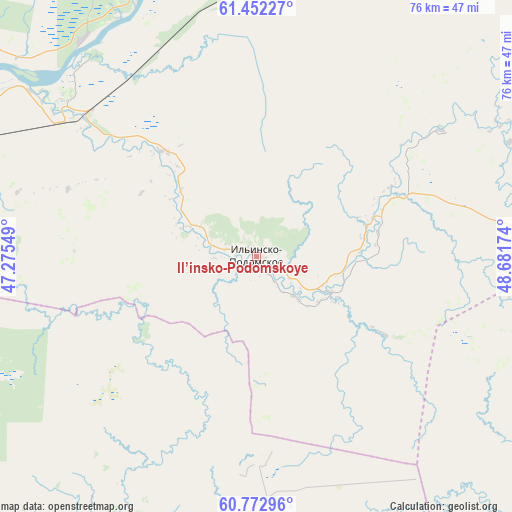
Il’insko-Podomskoye GPS coordinates[2]
61° 6' 51.984" North, 47° 58' 42.996" East
| Map corner | latitude | longitude |
|---|---|---|
| Upper-left | 61.45227°, | 47.27549° |
| Center: | 61.11444°, | 47.97861° |
| Lower-right: | 60.77296°, | 48.68174° |
| Map W x H: | 75.5×75.5 km | = 46.9×46.9mi |
| max Lat: | 73.50819° ⇑6.8% North |
| Il’insko-Podomskoye: | 61.11444° |
| min Lat: | ⇓93.2% South 41.28413° |
| min Long | Il’insko-Podo | max Long |
| -179.12198° | 47.97861° | 179.35046° |
| W 58.8%⇐ | ⇒41.2% E |
Elevation
Elevation of Il’insko-Podomskoye is 102 m = 335 ft, and this is 100.6 m = 330 ft below average elevation for this country.
| Max E: |
2518 m = 8261 ft | 70.2% |
| Avg. | 202.6 m = 665 ft | |
| Il’insko-Podomskoye | 102 m = 335 ft | |
Min E: |
-28 m = -92 ft | 29.8% |
See also: Russia elevation on elevation.city.
Geographical zone
Il’insko-Podomskoye is located in North temperate zone (between Tropic of Cancer and the Arctic Circle). Distance of this North polar circle is 605.9 km =376.5 mi to North.| Distance of | km | miles | from Il’insko-Podomskoye |
|---|---|---|---|
| North Pole | 3211.8 | 1995.7 | to North |
| Arctic Circle | 605.9 | 376.5 | to North |
| Tropic Cancer | 4189.4 | 2603.2 | to South |
| Equator | 6795.3 | 4222.4 | to South |


Nearby cities:
15 places around Il’insko-Podomskoye: (largest is in red/bold)
• Cheremushskiy
42.2 km =26.2 mi,  294°
294°
• Dem’yanovo
97.8 km =60.8 mi,  209°
209°
• Kharitonovo
40.9 km =25.4 mi,  321°
321°
• Khristoforovo
45.8 km =28.5 mi,  238°
238°
• Koryazhma
48.7 km =30.3 mi,  297°
297°
• Kotlas
73 km =45.4 mi,  282°
282°
• Krasavino
82.3 km =51.1 mi,  258°
258°
• Lal’sk
46.6 km =29 mi, 207°
• Luza
66.6 km =41.4 mi,  216°
216°
• Pinyug
96.6 km =60 mi,  186°
186°
• Privodino
79.5 km =49.4 mi,  266°
266°
• Shipitsyno
80.2 km =49.8 mi, 283°
• Sol’vychegodsk
61.8 km =38.4 mi, 292°
• Urdoma
77.1 km =47.9 mi,  22°
22°
• Vychegodskiy
59.7 km =37.1 mi, 284°
Sources, notices
• [Note1] Compared only with cities in Russia existing in our database
• [Src1] Map data: © OpenStreetMap contributors (CC-BY-SA)
• [Src2] Other city data from geonames.org with taken over terms of usage.
• [Src3] Geographical zone / Annual Mean Temperature by Robert A. Rohde @ Wikipedia
