Kerzhenets geodata
Kerzhenets (Nizhny Novgorod Oblast) is a populated place; located in Russia in Europe/Moscow (GMT+3) time zone. With population of 668 people, there are 4843 cities with bigger population in this country. Compared to other cities in Russia, 72.3% of cities are located further ↓South; 51.8% of cities are located further →East and 70.2% of cities have higher elevation than Kerzhenets. Note1


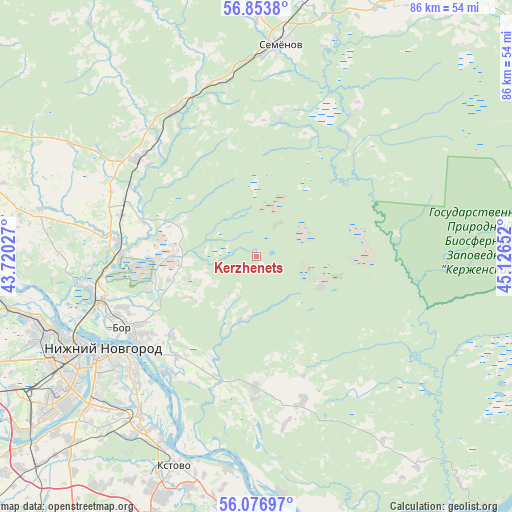
Kerzhenets GPS coordinates[2]
56° 28' 2.532" North, 44° 25' 24.204" East
| Map corner | latitude | longitude |
|---|---|---|
| Upper-left | 56.8538°, | 43.72027° |
| Center: | 56.46737°, | 44.42339° |
| Lower-right: | 56.07697°, | 45.12652° |
| Map W x H: | 86.4×86.4 km | = 53.7×53.7mi |
| max Lat: | 73.50819° ⇑27.7% North |
| Kerzhenets: | 56.46737° |
| min Lat: | ⇓72.3% South 41.28413° |
| min Long | Kerzhenets | max Long |
| -179.12198° | 44.42339° | 179.35046° |
| W 48.2%⇐ | ⇒51.8% E |
Elevation
Elevation of Kerzhenets is 102 m = 335 ft, and this is 100.6 m = 330 ft below average elevation for this country.
| Max E: |
2518 m = 8261 ft | 70.2% |
| Avg. | 202.6 m = 665 ft | |
| Kerzhenets | 102 m = 335 ft | |
Min E: |
-28 m = -92 ft | 29.8% |
See also: Russia elevation on elevation.city.
Geographical zone
Kerzhenets is located in North temperate zone (between Tropic of Cancer and the Arctic Circle). Distance of this North polar circle is 1122.6 km =697.6 mi to North.| Distance of | km | miles | from Kerzhenets |
|---|---|---|---|
| North Pole | 3728.5 | 2316.8 | to North |
| Arctic Circle | 1122.6 | 697.6 | to North |
| Tropic Cancer | 3672.7 | 2282.1 | to South |
| Equator | 6278.6 | 3901.3 | to South |


Nearby cities:
15 places around Kerzhenets: (largest is in red/bold)
• Afonino
30.5 km =19 mi,  221°
221°
• Bol’sheorlovskiy
12.1 km =7.5 mi,  114°
114°
• Bor
24.6 km =15.3 mi,  240°
240°
• Imeni M. I. Kalinina
32.5 km =20.2 mi,  190°
190°
• Kstovo
38.2 km =23.7 mi,  201°
201°
• Kuznechikha
32 km =19.9 mi,  227°
227°
• Linda
26 km =16.2 mi,  309°
309°
• Lyakhovo
37.6 km =23.4 mi, 226°
• Neklyudovo
28.1 km =17.5 mi,  257°
257°
• Nizhniy Novgorod
30.2 km =18.8 mi, 239°
• Pervoye Maya
38.4 km =23.9 mi,  151°
151°
• Podnov’ye
27.1 km =16.8 mi, 228°
• Semënov
35.8 km =22.2 mi,  6°
6°
• Sitniki
22 km =13.7 mi,  266°
266°
• Zelyony Gorod
38.7 km =24 mi,  213°
213°
Sources, notices
• [Note1] Compared only with cities in Russia existing in our database
• [Src1] Map data: © OpenStreetMap contributors (CC-BY-SA)
• [Src2] Other city data from geonames.org with taken over terms of usage.
• [Src3] Geographical zone / Annual Mean Temperature by Robert A. Rohde @ Wikipedia
