Bol’sheorlovskiy geodata
Bol’sheorlovskiy (Nizhny Novgorod Oblast) is a populated place; located in Russia in Europe/Moscow (GMT+3) time zone. With population of 836 people, there are 4737 cities with bigger population in this country. Compared to other cities in Russia, 71.8% of cities are located further ↓South; 51.2% of cities are located further →East and 70.6% of cities have higher elevation than Bol’sheorlovskiy. Note1


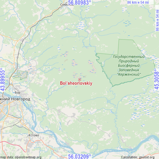
Bol’sheorlovskiy GPS coordinates[2]
56° 25' 22.62" North, 44° 36' 9.612" East
| Map corner | latitude | longitude |
|---|---|---|
| Upper-left | 56.80983°, | 43.89955° |
| Center: | 56.42295°, | 44.60267° |
| Lower-right: | 56.03209°, | 45.3058° |
| Map W x H: | 86.5×86.5 km | = 53.7×53.7mi |
| max Lat: | 73.50819° ⇑28.2% North |
| Bol’sheorlovskiy: | 56.42295° |
| min Lat: | ⇓71.8% South 41.28413° |
| min Long | Bol’sheorlovs | max Long |
| -179.12198° | 44.60267° | 179.35046° |
| W 48.8%⇐ | ⇒51.2% E |
Elevation
Elevation of Bol’sheorlovskiy is 101 m = 331 ft, and this is 101.6 m = 333 ft below average elevation for this country.
| Max E: |
2518 m = 8261 ft | 70.6% |
| Avg. | 202.6 m = 665 ft | |
| Bol’sheorlovskiy | 101 m = 331 ft | |
Min E: |
-28 m = -92 ft | 29.4% |
See also: Russia elevation on elevation.city.
Geographical zone
Bol’sheorlovskiy is located in North temperate zone (between Tropic of Cancer and the Arctic Circle). Distance of this North polar circle is 1127.5 km =700.6 mi to North.| Distance of | km | miles | from Bol’sheorlovskiy |
|---|---|---|---|
| North Pole | 3733.4 | 2319.8 | to North |
| Arctic Circle | 1127.5 | 700.6 | to North |
| Tropic Cancer | 3667.7 | 2279 | to South |
| Equator | 6273.6 | 3898.2 | to South |


Nearby cities:
15 places around Bol’sheorlovskiy: (largest is in red/bold)
• Afonino
36 km =22.4 mi,  240°
240°
• Bor
33.3 km =20.7 mi,  257°
257°
• Imeni M. I. Kalinina
31.9 km =19.8 mi,  211°
211°
• Kerzhenets
12.1 km =7.5 mi,  294°
294°
• Kstovo
39.5 km =24.5 mi,  219°
219°
• Kuznechikha
38.5 km =23.9 mi, 244°
• Linda
37.8 km =23.5 mi,  304°
304°
• Neklyudovo
38.5 km =23.9 mi,  268°
268°
• Nizhniy Novgorod
38.4 km =23.9 mi,  254°
254°
• Pamyat’ Parizhskoy Kommuny
36 km =22.4 mi,  190°
190°
• Pervoye Maya
29.7 km =18.5 mi,  165°
165°
• Podnov’ye
34 km =21.1 mi, 247°
• Rabotki
42.4 km =26.3 mi,  180°
180°
• Semënov
41.1 km =25.5 mi,  350°
350°
• Sitniki
33.1 km =20.6 mi,  276°
276°
Sources, notices
• [Note1] Compared only with cities in Russia existing in our database
• [Src1] Map data: © OpenStreetMap contributors (CC-BY-SA)
• [Src2] Other city data from geonames.org with taken over terms of usage.
• [Src3] Geographical zone / Annual Mean Temperature by Robert A. Rohde @ Wikipedia
