Kadoshkino geodata
Kadoshkino (Mordoviya Republic) is a populated place; located in Russia in Europe/Moscow (GMT+3) time zone. With population of 4,763 people, there are 2753 cities with bigger population in this country. Compared to other cities in Russia, 55% of cities are located further ↑North; 51.8% of cities are located further →East and 78.4% of cities have lower elevation than Kadoshkino. Note1


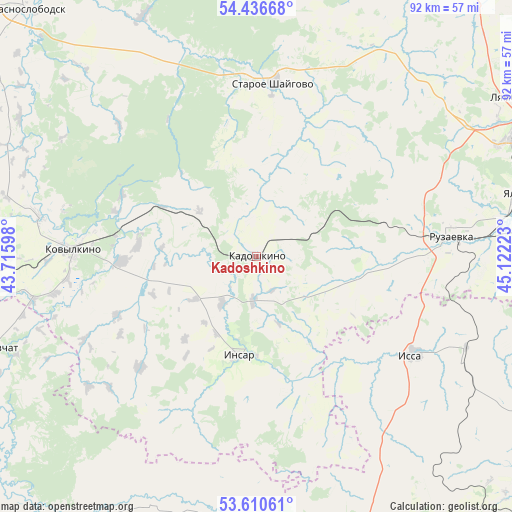
Kadoshkino GPS coordinates[2]
54° 1' 32.52" North, 44° 25' 8.76" East
| Map corner | latitude | longitude |
|---|---|---|
| Upper-left | 54.43668°, | 43.71598° |
| Center: | 54.0257°, | 44.4191° |
| Lower-right: | 53.61061°, | 45.12223° |
| Map W x H: | 91.9×91.8 km | = 57.1×57mi |
| max Lat: | 73.50819° ⇑55% North |
| Kadoshkino: | 54.0257° |
| min Lat: | ⇓45% South 41.28413° |
| min Long | Kadoshkino | max Long |
| -179.12198° | 44.4191° | 179.35046° |
| W 48.2%⇐ | ⇒51.8% E |
Elevation
Elevation of Kadoshkino is 237 m = 778 ft, and this is 34.4 m = 113 ft above average elevation for this country.
| Max E: |
2518 m = 8261 ft | 21.6% |
| Kadoshkino | 237 m 778 ft | |
| Avg. | 202.6 m = 665 ft | |
Min E: |
-28 m = -92 ft | 78.4% |
See also: Russia elevation on elevation.city.
Geographical zone
Kadoshkino is located in North temperate zone (between Tropic of Cancer and the Arctic Circle). Distance of this North polar circle is 1394.1 km =866.3 mi to North.| Distance of | km | miles | from Kadoshkino |
|---|---|---|---|
| North Pole | 4000 | 2485.5 | to North |
| Arctic Circle | 1394.1 | 866.3 | to North |
| Tropic Cancer | 3401.2 | 2113.4 | to South |
| Equator | 6007.1 | 3732.6 | to South |


Nearby cities:
15 places around Kadoshkino: (largest is in red/bold)
• Insar
18.1 km =11.2 mi,  189°
189°
• Issa
33.5 km =20.8 mi,  121°
121°
• Kochkurovo
65.3 km =40.6 mi,  89°
89°
• Kovylkino
33 km =20.5 mi,  272°
272°
• Krasnoslobodsk
60.4 km =37.5 mi,  317°
317°
• Lukhovka
56.3 km =35 mi,  75°
75°
• Lyambir’
54.1 km =33.6 mi,  58°
58°
• Narovchat
50.2 km =31.2 mi,  250°
250°
• Nikolayevka
49.1 km =30.5 mi,  74°
74°
• Ruzayevka
35 km =21.7 mi, 83°
• Saransk
52.3 km =32.5 mi, 70°
• Skanovo
46.6 km =29 mi, 247°
• Staraya Terizmorga
27.1 km =16.8 mi,  15°
15°
• Tatarskaya Pishlya
31.6 km =19.6 mi, 82°
• Zykovo
43.8 km =27.2 mi, 83°
Sources, notices
• [Note1] Compared only with cities in Russia existing in our database
• [Src1] Map data: © OpenStreetMap contributors (CC-BY-SA)
• [Src2] Other city data from geonames.org with taken over terms of usage.
• [Src3] Geographical zone / Annual Mean Temperature by Robert A. Rohde @ Wikipedia
