Izhevskoye geodata
Izhevskoye (Ryazan Oblast) is a populated place; located in Russia in Europe/Moscow (GMT+3) time zone. With population of 3,703 people, there are 3267 cities with bigger population in this country. Compared to other cities in Russia, 50.7% of cities are located further ↑North; 63.5% of cities are located further →East and 71.9% of cities have higher elevation than Izhevskoye. Note1


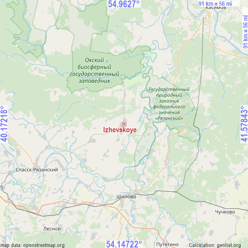
Izhevskoye GPS coordinates[2]
54° 33' 25.2" North, 40° 52' 31.08" East
| Map corner | latitude | longitude |
|---|---|---|
| Upper-left | 54.9627°, | 40.17218° |
| Center: | 54.557°, | 40.8753° |
| Lower-right: | 54.14722°, | 41.57843° |
| Map W x H: | 90.7×90.7 km | = 56.4×56.4mi |
| max Lat: | 73.50819° ⇑50.7% North |
| Izhevskoye: | 54.557° |
| min Lat: | ⇓49.3% South 41.28413° |
| min Long | Izhevskoye | max Long |
| -179.12198° | 40.8753° | 179.35046° |
| W 36.5%⇐ | ⇒63.5% E |
Elevation
Elevation of Izhevskoye is 98 m = 322 ft, and this is 104.6 m = 343 ft below average elevation for this country.
| Max E: |
2518 m = 8261 ft | 71.9% |
| Avg. | 202.6 m = 665 ft | |
| Izhevskoye | 98 m = 322 ft | |
Min E: |
-28 m = -92 ft | 28.1% |
See also: Russia elevation on elevation.city.
Geographical zone
Izhevskoye is located in North temperate zone (between Tropic of Cancer and the Arctic Circle). Distance of this North polar circle is 1335 km =829.5 mi to North.| Distance of | km | miles | from Izhevskoye |
|---|---|---|---|
| North Pole | 3940.9 | 2448.8 | to North |
| Arctic Circle | 1335 | 829.5 | to North |
| Tropic Cancer | 3460.3 | 2150.1 | to South |
| Equator | 6066.2 | 3769.4 | to South |


Nearby cities:
15 places around Izhevskoye: (largest is in red/bold)
• Chuchkovo
48.9 km =30.4 mi,  130°
130°
• Gus’-Zheleznyy
58.7 km =36.5 mi,  18°
18°
• Kasimov
54.2 km =33.7 mi,  38°
38°
• Kiritsy
45.1 km =28 mi,  228°
228°
• Lashma
45.1 km =28 mi, 22°
• Lesnoy
46.4 km =28.8 mi,  214°
214°
• Morozovy-Borki
66.6 km =41.4 mi,  177°
177°
• Murmino
53.1 km =33 mi,  275°
275°
• Pitelino
60.6 km =37.7 mi,  87°
87°
• Putyatino
46.8 km =29.1 mi,  160°
160°
• Sapozhok
69.5 km =43.2 mi,  190°
190°
• Shilovo
26.3 km =16.3 mi, 180°
• Spassk-Ryazanskiy
36.5 km =22.7 mi,  242°
242°
• Syntul
56.5 km =35.1 mi,  28°
28°
• Tuma
68.9 km =42.8 mi,  342°
342°
Sources, notices
• [Note1] Compared only with cities in Russia existing in our database
• [Src1] Map data: © OpenStreetMap contributors (CC-BY-SA)
• [Src2] Other city data from geonames.org with taken over terms of usage.
• [Src3] Geographical zone / Annual Mean Temperature by Robert A. Rohde @ Wikipedia
