Promysla geodata
Promysla (Perm) is a populated place; located in Russia in Asia/Yekaterinburg (GMT+5) time zone. With population of 728 people, there are 4792 cities with bigger population in this country. Compared to other cities in Russia, 85.1% of cities are located further ↓South; 70.5% of cities are located further ←West and 85.7% of cities have lower elevation than Promysla. Note1


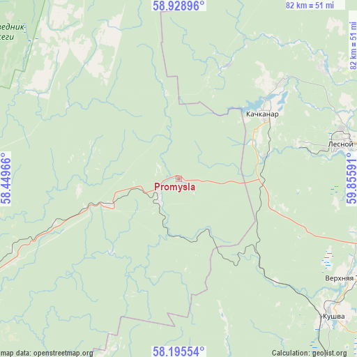
Promysla GPS coordinates[2]
58° 33' 51.012" North, 59° 9' 10.008" East
| Map corner | latitude | longitude |
|---|---|---|
| Upper-left | 58.92896°, | 58.44966° |
| Center: | 58.56417°, | 59.15278° |
| Lower-right: | 58.19554°, | 59.85591° |
| Map W x H: | 81.5×81.5 km | = 50.6×50.6mi |
| max Lat: | 73.50819° ⇑14.9% North |
| Promysla: | 58.56417° |
| min Lat: | ⇓85.1% South 41.28413° |
| min Long | Promysla | max Long |
| -179.12198° | 59.15278° | 179.35046° |
| W 70.5%⇐ | ⇒29.5% E |
Elevation
Elevation of Promysla is 337 m = 1106 ft, and this is 134.4 m = 441 ft above average elevation for this country.
| Max E: |
2518 m = 8261 ft | 14.3% |
| Promysla | 337 m 1106 ft | |
| Avg. | 202.6 m = 665 ft | |
Min E: |
-28 m = -92 ft | 85.7% |
See also: Russia elevation on elevation.city.
Geographical zone
Promysla is located in North temperate zone (between Tropic of Cancer and the Arctic Circle). Distance of this North polar circle is 889.4 km =552.6 mi to North.| Distance of | km | miles | from Promysla |
|---|---|---|---|
| North Pole | 3495.3 | 2171.9 | to North |
| Arctic Circle | 889.4 | 552.6 | to North |
| Tropic Cancer | 3905.8 | 2427 | to South |
| Equator | 6511.7 | 4046.2 | to South |


Nearby cities:
15 places around Promysla: (largest is in red/bold)
• Baranchinskiy
54.9 km =34.1 mi,  144°
144°
• Gornozavodsk
52.7 km =32.7 mi,  246°
246°
• Is
41.3 km =25.7 mi,  52°
52°
• Kachkanar
24.4 km =15.2 mi, 51°
• Kushva
46.6 km =29 mi,  130°
130°
• Lesnoy
38.5 km =23.9 mi,  77°
77°
• Medvedka
19.8 km =12.3 mi,  351°
351°
• Nizhnyaya Tura
38.9 km =24.2 mi, 79°
• Pashiya
54.1 km =33.6 mi, 254°
• Sarany
17.2 km =10.7 mi, 245°
• Staryy Biser
23 km =14.3 mi,  223°
223°
• Tëplaya Gora
6.4 km =4 mi,  226°
226°
• Valerianovsk
32.1 km =19.9 mi, 47°
• Verkhnyaya Tura
44.2 km =27.5 mi,  120°
120°
• Yëlkino
41.8 km =26 mi,  70°
70°
Sources, notices
• [Note1] Compared only with cities in Russia existing in our database
• [Src1] Map data: © OpenStreetMap contributors (CC-BY-SA)
• [Src2] Other city data from geonames.org with taken over terms of usage.
• [Src3] Geographical zone / Annual Mean Temperature by Robert A. Rohde @ Wikipedia
