Dmitriyevka geodata
Dmitriyevka (Bashkortostan Republic) is a populated place; located in Russia in Asia/Yekaterinburg (GMT+5) time zone. With population of 3,796 people, there are 3216 cities with bigger population in this country. Compared to other cities in Russia, 50.9% of cities are located further ↓South; 66.7% of cities are located further ←West and 56.8% of cities have lower elevation than Dmitriyevka. Note1


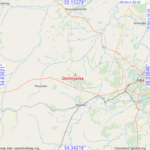
Dmitriyevka GPS coordinates[2]
54° 45' 0" North, 55° 19' 59.988" East
| Map corner | latitude | longitude |
|---|---|---|
| Upper-left | 55.15378°, | 54.63021° |
| Center: | 54.75°, | 55.33333° |
| Lower-right: | 54.34216°, | 56.03646° |
| Map W x H: | 90.2×90.2 km | = 56×56mi |
| max Lat: | 73.50819° ⇑49.1% North |
| Dmitriyevka: | 54.75° |
| min Lat: | ⇓50.9% South 41.28413° |
| min Long | Dmitriyevka | max Long |
| -179.12198° | 55.33333° | 179.35046° |
| W 66.7%⇐ | ⇒33.3% E |
Elevation
Elevation of Dmitriyevka is 160 m = 525 ft, and this is 42.6 m = 140 ft below average elevation for this country.
| Max E: |
2518 m = 8261 ft | 43.2% |
| Avg. | 202.6 m = 665 ft | |
| Dmitriyevka | 160 m = 525 ft | |
Min E: |
-28 m = -92 ft | 56.8% |
See also: Russia elevation on elevation.city.
Geographical zone
Dmitriyevka is located in North temperate zone (between Tropic of Cancer and the Arctic Circle). Distance of this North polar circle is 1313.5 km =816.2 mi to North.| Distance of | km | miles | from Dmitriyevka |
|---|---|---|---|
| North Pole | 3919.4 | 2435.4 | to North |
| Arctic Circle | 1313.5 | 816.2 | to North |
| Tropic Cancer | 3481.7 | 2163.4 | to South |
| Equator | 6087.6 | 3782.7 | to South |


Nearby cities:
15 places around Dmitriyevka: (largest is in red/bold)
• Alekseyevka
12.8 km =8 mi,  330°
330°
• Asanovo
18.9 km =11.7 mi,  32°
32°
• Avdon
26.3 km =16.3 mi,  110°
110°
• Blagoveshchensk
52 km =32.3 mi,  52°
52°
• Bulgakovo
45.3 km =28.1 mi,  128°
128°
• Buzdyak
53.7 km =33.4 mi,  249°
249°
• Chekmagush
60.6 km =37.7 mi,  314°
314°
• Chesnokovka
42.2 km =26.2 mi, 111°
• Chishmy
19.5 km =12.1 mi,  171°
171°
• Davlekanovo
61.9 km =38.5 mi,  198°
198°
• Iskino
45.2 km =28.1 mi,  124°
124°
• Kabakovo
57.7 km =35.9 mi, 114°
• Kushnarënkovo
39.5 km =24.5 mi,  1°
1°
• Mikhaylovka
36.3 km =22.6 mi,  80°
80°
• Ufa
40.7 km =25.3 mi,  91°
91°
Sources, notices
• [Note1] Compared only with cities in Russia existing in our database
• [Src1] Map data: © OpenStreetMap contributors (CC-BY-SA)
• [Src2] Other city data from geonames.org with taken over terms of usage.
• [Src3] Geographical zone / Annual Mean Temperature by Robert A. Rohde @ Wikipedia
