Chishmy geodata
Chishmy (Bashkortostan Republic) is a populated place; located in Russia in Asia/Yekaterinburg (GMT+5) time zone. With population of 22,000 people, there are 817 cities with bigger population in this country. Compared to other cities in Russia, 50.5% of cities are located further ↑North; 66.8% of cities are located further ←West and 68.2% of cities have higher elevation than Chishmy. Note1


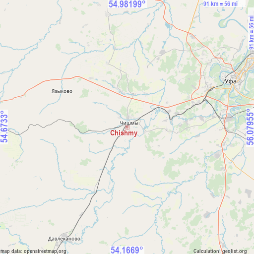
Chishmy GPS coordinates[2]
54° 34' 35.328" North, 55° 22' 35.112" East
| Map corner | latitude | longitude |
|---|---|---|
| Upper-left | 54.98199°, | 54.6733° |
| Center: | 54.57648°, | 55.37642° |
| Lower-right: | 54.1669°, | 56.07955° |
| Map W x H: | 90.6×90.6 km | = 56.3×56.3mi |
| max Lat: | 73.50819° ⇑50.5% North |
| Chishmy: | 54.57648° |
| min Lat: | ⇓49.5% South 41.28413° |
| min Long | Chishmy | max Long |
| -179.12198° | 55.37642° | 179.35046° |
| W 66.8%⇐ | ⇒33.2% E |
Elevation
Elevation of Chishmy is 107 m = 351 ft, and this is 95.6 m = 314 ft below average elevation for this country.
| Max E: |
2518 m = 8261 ft | 68.2% |
| Avg. | 202.6 m = 665 ft | |
| Chishmy | 107 m = 351 ft | |
Min E: |
-28 m = -92 ft | 31.8% |
See also: Russia elevation on elevation.city.
Geographical zone
Chishmy is located in North temperate zone (between Tropic of Cancer and the Arctic Circle). Distance of this North polar circle is 1332.8 km =828.2 mi to North.| Distance of | km | miles | from Chishmy |
|---|---|---|---|
| North Pole | 3938.7 | 2447.4 | to North |
| Arctic Circle | 1332.8 | 828.2 | to North |
| Tropic Cancer | 3462.4 | 2151.4 | to South |
| Equator | 6068.3 | 3770.7 | to South |


Nearby cities:
15 places around Chishmy: (largest is in red/bold)
• Alekseyevka
31.8 km =19.8 mi,  343°
343°
• Asanovo
36.1 km =22.4 mi,  11°
11°
• Avdon
24.1 km =15 mi,  65°
65°
• Bulgakovo
33.9 km =21.1 mi,  105°
105°
• Buzdyak
53.3 km =33.1 mi,  270°
270°
• Chesnokovka
36.9 km =22.9 mi,  83°
83°
• Davlekanovo
45.3 km =28.1 mi,  209°
209°
• Dmitriyevka
19.5 km =12.1 mi,  351°
351°
• Iskino
35.1 km =21.8 mi,  100°
100°
• Kabakovo
50.2 km =31.2 mi, 95°
• Karmaskaly
56.9 km =35.4 mi, 113°
• Kushnarënkovo
58.8 km =36.5 mi,  358°
358°
• Mikhaylovka
41.8 km =26 mi,  52°
52°
• Ufa
42.3 km =26.3 mi,  64°
64°
• Ulukulevo
63 km =39.1 mi, 104°
Sources, notices
• [Note1] Compared only with cities in Russia existing in our database
• [Src1] Map data: © OpenStreetMap contributors (CC-BY-SA)
• [Src2] Other city data from geonames.org with taken over terms of usage.
• [Src3] Geographical zone / Annual Mean Temperature by Robert A. Rohde @ Wikipedia
