Berëznik geodata
Berëznik (Arkhangelskaya) is a populated place; located in Russia in Europe/Moscow (GMT+3) time zone. With population of 6,218 people, there are 2200 cities with bigger population in this country. Compared to other cities in Russia, 96.1% of cities are located further ↓South; 57.8% of cities are located further →East and 94% of cities have higher elevation than Berëznik. Note1


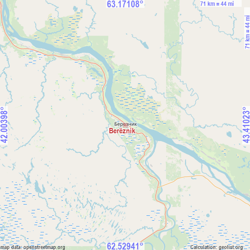
Berëznik GPS coordinates[2]
62° 51' 7.2" North, 42° 42' 25.56" East
| Map corner | latitude | longitude |
|---|---|---|
| Upper-left | 63.17108°, | 42.00398° |
| Center: | 62.852°, | 42.7071° |
| Lower-right: | 62.52941°, | 43.41023° |
| Map W x H: | 71.3×71.3 km | = 44.3×44.3mi |
| max Lat: | 73.50819° ⇑3.9% North |
| Berëznik: | 62.852° |
| min Lat: | ⇓96.1% South 41.28413° |
| min Long | Berëznik | max Long |
| -179.12198° | 42.7071° | 179.35046° |
| W 42.2%⇐ | ⇒57.8% E |
Elevation
Elevation of Berëznik is 15 m = 49 ft, and this is 187.6 m = 615 ft below average elevation for this country.
| Max E: |
2518 m = 8261 ft | 94% |
| Avg. | 202.6 m = 665 ft | |
| Berëznik | 15 m = 49 ft | |
Min E: |
-28 m = -92 ft | 6% |
See also: Russia elevation on elevation.city.
Geographical zone
Berëznik is located in North temperate zone (between Tropic of Cancer and the Arctic Circle). Distance of this North polar circle is 412.7 km =256.4 mi to North.| Distance of | km | miles | from Berëznik |
|---|---|---|---|
| North Pole | 3018.6 | 1875.7 | to North |
| Arctic Circle | 412.7 | 256.4 | to North |
| Tropic Cancer | 4382.6 | 2723.2 | to South |
| Equator | 6988.5 | 4342.5 | to South |


Nearby cities:
15 places around Berëznik: (largest is in red/bold)
• Belogorskiy
149.8 km =93.1 mi,  353°
353°
• Dvinskoy
146.2 km =90.8 mi,  122°
122°
• Karpogory
154.3 km =95.9 mi,  34°
34°
• Kholmogory
161.1 km =100.1 mi,  341°
341°
• Mirnyy
120.8 km =75.1 mi,  265°
265°
• Oksovskiy
145.7 km =90.5 mi,  259°
259°
• Plesetsk
123.9 km =77 mi, 262°
• Puksoozero
110.9 km =68.9 mi,  254°
254°
• Rochegda
41.4 km =25.7 mi, 119°
• Samoded
138.4 km =86 mi,  307°
307°
• Shalakusha
143.8 km =89.4 mi,  240°
240°
• Shenkursk
83.2 km =51.7 mi,  173°
173°
• Verkhnyaya Toyma
136.2 km =84.6 mi, 120°
• Yemetsk
83.2 km =51.7 mi,  325°
325°
• Yemtsa
122.5 km =76.1 mi,  281°
281°
Sources, notices
• [Note1] Compared only with cities in Russia existing in our database
• [Src1] Map data: © OpenStreetMap contributors (CC-BY-SA)
• [Src2] Other city data from geonames.org with taken over terms of usage.
• [Src3] Geographical zone / Annual Mean Temperature by Robert A. Rohde @ Wikipedia
