Baranchinskiy geodata
Baranchinskiy (Sverdlovsk) is a populated place; located in Russia in Asia/Yekaterinburg (GMT+5) time zone. With population of 10,970 people, there are 1377 cities with bigger population in this country. Compared to other cities in Russia, 83.3% of cities are located further ↓South; 71% of cities are located further ←West and 76.1% of cities have lower elevation than Baranchinskiy. Note1


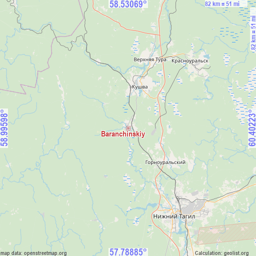
Baranchinskiy GPS coordinates[2]
58° 9' 42.12" North, 59° 41' 56.76" East
| Map corner | latitude | longitude |
|---|---|---|
| Upper-left | 58.53069°, | 58.99598° |
| Center: | 58.1617°, | 59.6991° |
| Lower-right: | 57.78885°, | 60.40223° |
| Map W x H: | 82.5×82.5 km | = 51.3×51.3mi |
| max Lat: | 73.50819° ⇑16.7% North |
| Baranchinskiy: | 58.1617° |
| min Lat: | ⇓83.3% South 41.28413° |
| min Long | Baranchinskiy | max Long |
| -179.12198° | 59.6991° | 179.35046° |
| W 71%⇐ | ⇒29% E |
Elevation
Elevation of Baranchinskiy is 221 m = 725 ft, and this is 18.4 m = 60 ft above average elevation for this country.
| Max E: |
2518 m = 8261 ft | 23.9% |
| Baranchinskiy | 221 m 725 ft | |
| Avg. | 202.6 m = 665 ft | |
Min E: |
-28 m = -92 ft | 76.1% |
See also: Russia elevation on elevation.city.
Geographical zone
Baranchinskiy is located in North temperate zone (between Tropic of Cancer and the Arctic Circle). Distance of this North polar circle is 934.2 km =580.5 mi to North.| Distance of | km | miles | from Baranchinskiy |
|---|---|---|---|
| North Pole | 3540.1 | 2199.7 | to North |
| Arctic Circle | 934.2 | 580.5 | to North |
| Tropic Cancer | 3861.1 | 2399.2 | to South |
| Equator | 6467 | 4018.4 | to South |


Nearby cities:
15 places around Baranchinskiy: (largest is in red/bold)
• Chernoistochinsk
48.4 km =30.1 mi,  167°
167°
• Krasnoural’sk
30.1 km =18.7 mi,  41°
41°
• Kushva
14.8 km =9.2 mi,  13°
13°
• Lesnoy
53.2 km =33.1 mi, 6°
• Nikolo-Pavlovskoye
47.1 km =29.3 mi,  153°
153°
• Nizhny Tagil
31.2 km =19.4 mi, 149°
• Nizhnyaya Tura
52.4 km =32.6 mi, 7°
• Promysla
54.9 km =34.1 mi,  324°
324°
• Sinegorskiy
31.6 km =19.6 mi,  199°
199°
• Staryy Biser
55.5 km =34.5 mi,  300°
300°
• Svobodnyy
43.1 km =26.8 mi,  108°
108°
• Tëplaya Gora
54.4 km =33.8 mi, 317°
• Uralets
55.7 km =34.6 mi,  183°
183°
• Verkhnyaya Salda
52.1 km =32.4 mi,  103°
103°
• Verkhnyaya Tura
23 km =14.3 mi,  15°
15°
Sources, notices
• [Note1] Compared only with cities in Russia existing in our database
• [Src1] Map data: © OpenStreetMap contributors (CC-BY-SA)
• [Src2] Other city data from geonames.org with taken over terms of usage.
• [Src3] Geographical zone / Annual Mean Temperature by Robert A. Rohde @ Wikipedia
