Verkhnyaya Tura geodata
Verkhnyaya Tura (Sverdlovsk) is a populated place; located in Russia in Asia/Yekaterinburg (GMT+5) time zone. With population of 10,608 people, there are 1430 cities with bigger population in this country. Compared to other cities in Russia, 84.1% of cities are located further ↓South; 71.2% of cities are located further ←West and 74% of cities have lower elevation than Verkhnyaya Tura. Note1


Verkhnyaya Tura GPS coordinates[2]
58° 21' 38.988" North, 59° 48' 24.012" East
| Map corner | latitude | longitude |
|---|---|---|
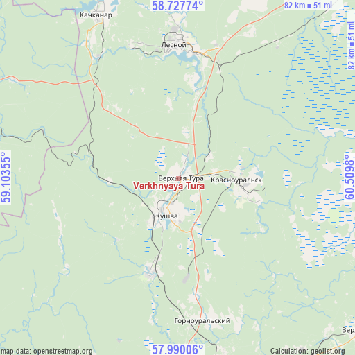
| Upper-left | 58.72774°, | 59.10355° |
| Center: | 58.36083°, | 59.80667° |
| Lower-right: | 57.99006°, | 60.5098° |
| Map W x H: | 82×82 km | = 51×51mi |
| max Lat: | 73.50819° ⇑15.9% North |
| Verkhnyaya Tura: | 58.36083° |
| min Lat: | ⇓84.1% South 41.28413° |
| min Long | Verkhnyaya Tura | max Long |
| -179.12198° | 59.80667° | 179.35046° |
| W 71.2%⇐ | ⇒28.8% E |
Elevation
Elevation of Verkhnyaya Tura is 212 m = 696 ft, and this is 9.4 m = 31 ft above average elevation for this country.
| Max E: |
2518 m = 8261 ft | 26% |
| Verkhnyaya Tura | 212 m 696 ft | |
| Avg. | 202.6 m = 665 ft | |
Min E: |
-28 m = -92 ft | 74% |
See also: Russia elevation on elevation.city.
Geographical zone
Verkhnyaya Tura is located in North temperate zone (between Tropic of Cancer and the Arctic Circle). Distance of this North polar circle is 912.1 km =566.8 mi to North.| Distance of | km | miles | from Verkhnyaya Tura |
|---|---|---|---|
| North Pole | 3517.9 | 2185.9 | to North |
| Arctic Circle | 912.1 | 566.8 | to North |
| Tropic Cancer | 3883.2 | 2412.9 | to South |
| Equator | 6489.1 | 4032.1 | to South |


Nearby cities:
15 places around Verkhnyaya Tura: (largest is in red/bold)
• Baranchinskiy
23 km =14.3 mi,  195°
195°
• Is
48.1 km =29.9 mi,  353°
353°
• Kachkanar
42.1 km =26.2 mi,  333°
333°
• Krasnoural’sk
13.7 km =8.5 mi,  88°
88°
• Kushva
8.3 km =5.2 mi, 199°
• Lesnoy
30.7 km =19.1 mi,  359°
359°
• Nizhny Tagil
49.9 km =31 mi,  169°
169°
• Nizhnyaya Tura
29.9 km =18.6 mi,  0°
0°
• Promysla
44.2 km =27.5 mi,  300°
300°
• Sinegorskiy
54.6 km =33.9 mi, 198°
• Staryy Biser
54.3 km =33.7 mi,  276°
276°
• Svobodnyy
49.7 km =30.9 mi,  135°
135°
• Tëplaya Gora
46.4 km =28.8 mi,  293°
293°
• Valerianovsk
46.7 km =29 mi,  342°
342°
• Yëlkino
36.9 km =22.9 mi, 2°
In other languages:
- In Spanish: Vérjniaya Turá
- In France: Verkhniaïa Toura
- In German: Werchnjaja Tura
- In Italian: Verchnjaja Tura
- In Russian: Верхняя Тура
- In Chinese: 上圖拉
Sources, notices
• [Note1] Compared only with cities in Russia existing in our database
• [Src1] Map data: © OpenStreetMap contributors (CC-BY-SA)
• [Src2] Other city data from geonames.org with taken over terms of usage.
• [Src3] Geographical zone / Annual Mean Temperature by Robert A. Rohde @ Wikipedia
