Levokumskoye geodata
Levokumskoye (Stavropol’ Kray) is a populated place; located in Russia in Europe/Moscow (GMT+3) time zone. With population of 11,377 people, there are 1335 cities with bigger population in this country. Compared to other cities in Russia, 88.2% of cities are located further ↑North; 51% of cities are located further →East and 80.9% of cities have higher elevation than Levokumskoye. Note1


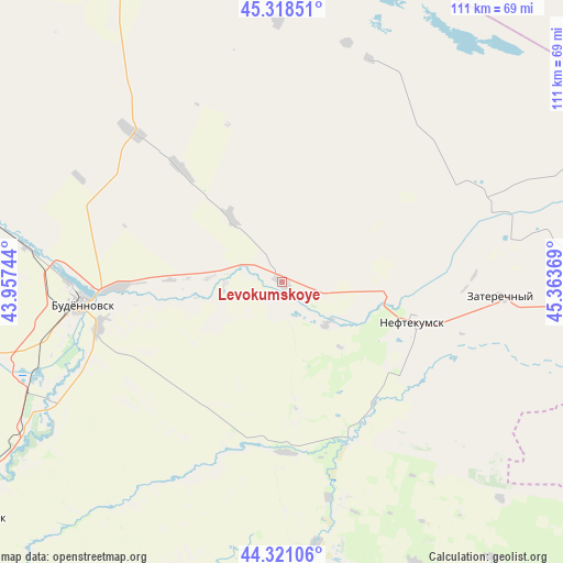
Levokumskoye GPS coordinates[2]
44° 49' 18.984" North, 44° 39' 38.016" East
| Map corner | latitude | longitude |
|---|---|---|
| Upper-left | 45.31851°, | 43.95744° |
| Center: | 44.82194°, | 44.66056° |
| Lower-right: | 44.32106°, | 45.36369° |
| Map W x H: | 110.9×110.9 km | = 68.9×68.9mi |
| max Lat: | 73.50819° ⇑88.2% North |
| Levokumskoye: | 44.82194° |
| min Lat: | ⇓11.8% South 41.28413° |
| min Long | Levokumskoye | max Long |
| -179.12198° | 44.66056° | 179.35046° |
| W 49%⇐ | ⇒51% E |
Elevation
Elevation of Levokumskoye is 68 m = 223 ft, and this is 134.6 m = 442 ft below average elevation for this country.
| Max E: |
2518 m = 8261 ft | 80.9% |
| Avg. | 202.6 m = 665 ft | |
| Levokumskoye | 68 m = 223 ft | |
Min E: |
-28 m = -92 ft | 19.1% |
See also: Russia elevation on elevation.city.
Geographical zone
Levokumskoye is located in North temperate zone (between Tropic of Cancer and the Arctic Circle). Distance of this Northern Tropic circle is 2377.8 km =1477.5 mi to South.| Distance of | km | miles | from Levokumskoye |
|---|---|---|---|
| North Pole | 5023.3 | 3121.3 | to North |
| Arctic Circle | 2417.4 | 1502.1 | to North |
| Tropic Cancer | 2377.8 | 1477.5 | to South |
| Equator | 4983.7 | 3096.7 | to South |


Nearby cities:
15 places around Levokumskoye: (largest is in red/bold)
• Achikulak
33.2 km =20.6 mi,  155°
155°
• Budënnovsk
39.3 km =24.4 mi,  263°
263°
• Irgakly
51.8 km =32.2 mi,  171°
171°
• Kara-Tyube
64.8 km =40.3 mi,  108°
108°
• Kayasula
61.4 km =38.2 mi,  154°
154°
• Neftekumsk
27.2 km =16.9 mi, 105°
• Orlovka
41 km =25.5 mi,  249°
249°
• Pokoynoye
32.3 km =20.1 mi,  267°
267°
• Praskoveya
37.1 km =23.1 mi, 256°
• Pravokumskoye
5.9 km =3.7 mi,  190°
190°
• Starodubskoye
58.6 km =36.4 mi,  240°
240°
• Stepnoye
61.6 km =38.3 mi, 185°
• Urozhaynoye
21 km =13 mi,  100°
100°
• Vostochny
67.3 km =41.8 mi,  213°
213°
• Zaterechnyy
43.4 km =27 mi,  94°
94°
Sources, notices
• [Note1] Compared only with cities in Russia existing in our database
• [Src1] Map data: © OpenStreetMap contributors (CC-BY-SA)
• [Src2] Other city data from geonames.org with taken over terms of usage.
• [Src3] Geographical zone / Annual Mean Temperature by Robert A. Rohde @ Wikipedia
