Kovalevskoye geodata
Kovalevskoye (Krasnodarskiy) is a populated place; located in Russia in Europe/Moscow (GMT+3) time zone. With population of 3,139 people, there are 3662 cities with bigger population in this country. Compared to other cities in Russia, 86.5% of cities are located further ↑North; 63.3% of cities are located further →East and 51.1% of cities have higher elevation than Kovalevskoye. Note1


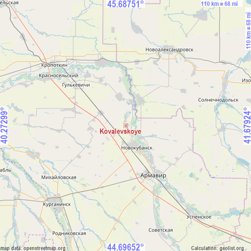
Kovalevskoye GPS coordinates[2]
45° 11' 39.012" North, 40° 58' 33.996" East
| Map corner | latitude | longitude |
|---|---|---|
| Upper-left | 45.68751°, | 40.27299° |
| Center: | 45.19417°, | 40.97611° |
| Lower-right: | 44.69652°, | 41.67924° |
| Map W x H: | 110.2×110.2 km | = 68.5×68.5mi |
| max Lat: | 73.50819° ⇑86.5% North |
| Kovalevskoye: | 45.19417° |
| min Lat: | ⇓13.5% South 41.28413° |
| min Long | Kovalevskoye | max Long |
| -179.12198° | 40.97611° | 179.35046° |
| W 36.7%⇐ | ⇒63.3% E |
Elevation
Elevation of Kovalevskoye is 142 m = 466 ft, and this is 60.6 m = 199 ft below average elevation for this country.
| Max E: |
2518 m = 8261 ft | 51.1% |
| Avg. | 202.6 m = 665 ft | |
| Kovalevskoye | 142 m = 466 ft | |
Min E: |
-28 m = -92 ft | 48.9% |
See also: Russia elevation on elevation.city.
Geographical zone
Kovalevskoye is located in North temperate zone (between Tropic of Cancer and the Arctic Circle). Distance of this North polar circle is 2376.1 km =1476.4 mi to North.| Distance of | km | miles | from Kovalevskoye |
|---|---|---|---|
| North Pole | 4981.9 | 3095.6 | to North |
| Arctic Circle | 2376.1 | 1476.4 | to North |
| Tropic Cancer | 2419.2 | 1503.2 | to South |
| Equator | 5025.1 | 3122.5 | to South |


Nearby cities:
15 places around Kovalevskoye: (largest is in red/bold)
• Armavir
25.6 km =15.9 mi,  153°
153°
• Glubokiy
27.7 km =17.2 mi,  173°
173°
• Grigoropolisskaya
13.1 km =8.1 mi,  28°
28°
• Gul’kevichi
28.3 km =17.6 mi,  308°
308°
• Krasnaya Polyana
18.4 km =11.4 mi, 147°
• Maykopskoye
27.6 km =17.1 mi,  323°
323°
• Novokubansk
9.5 km =5.9 mi,  155°
155°
• Otrado-Kubanskoye
12 km =7.5 mi,  297°
297°
• Prikubanskiy
26.7 km =16.6 mi,  143°
143°
• Prochnookopskaya
18 km =11.2 mi, 141°
• Sokolovskoye
24.3 km =15.1 mi,  287°
287°
• Staraya Stanitsa
24.7 km =15.3 mi, 146°
• Temizhbekskaya
28.9 km =18 mi,  9°
9°
• Temizhbekskaya
29.8 km =18.5 mi,  339°
339°
• Ventsy
23 km =14.3 mi,  331°
331°
Sources, notices
• [Note1] Compared only with cities in Russia existing in our database
• [Src1] Map data: © OpenStreetMap contributors (CC-BY-SA)
• [Src2] Other city data from geonames.org with taken over terms of usage.
• [Src3] Geographical zone / Annual Mean Temperature by Robert A. Rohde @ Wikipedia
