Lermontovo geodata
Lermontovo (Krasnodarskiy) is a populated place; located in Russia in Europe/Moscow (GMT+3) time zone. With population of 1,100 people, there are 4575 cities with bigger population in this country. Compared to other cities in Russia, 90.2% of cities are located further ↑North; 73.3% of cities are located further →East and 87% of cities have higher elevation than Lermontovo. Note1


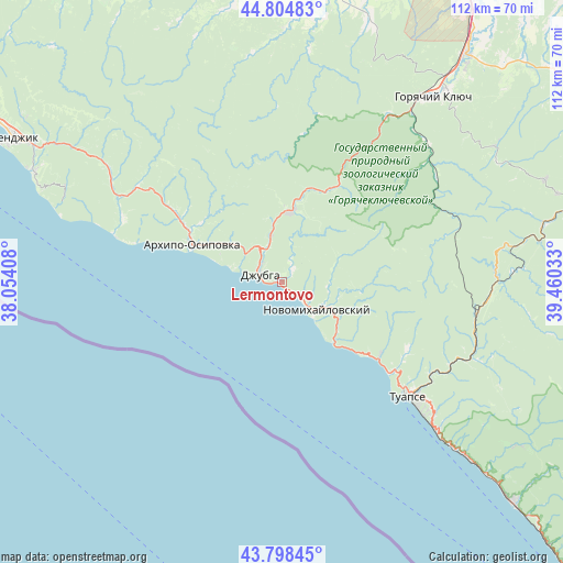
Lermontovo GPS coordinates[2]
44° 18' 13.68" North, 38° 45' 25.92" East
| Map corner | latitude | longitude |
|---|---|---|
| Upper-left | 44.80483°, | 38.05408° |
| Center: | 44.3038°, | 38.7572° |
| Lower-right: | 43.79845°, | 39.46033° |
| Map W x H: | 111.9×111.9 km | = 69.5×69.5mi |
| max Lat: | 73.50819° ⇑90.2% North |
| Lermontovo: | 44.3038° |
| min Lat: | ⇓9.8% South 41.28413° |
| min Long | Lermontovo | max Long |
| -179.12198° | 38.7572° | 179.35046° |
| W 26.7%⇐ | ⇒73.3% E |
Elevation
Elevation of Lermontovo is 40 m = 131 ft, and this is 162.6 m = 533 ft below average elevation for this country.
| Max E: |
2518 m = 8261 ft | 87% |
| Avg. | 202.6 m = 665 ft | |
| Lermontovo | 40 m = 131 ft | |
Min E: |
-28 m = -92 ft | 13% |
See also: Russia elevation on elevation.city.
Geographical zone
Lermontovo is located in North temperate zone (between Tropic of Cancer and the Arctic Circle). Distance of this Northern Tropic circle is 2320.2 km =1441.7 mi to South.| Distance of | km | miles | from Lermontovo |
|---|---|---|---|
| North Pole | 5080.9 | 3157.1 | to North |
| Arctic Circle | 2475.1 | 1538 | to North |
| Tropic Cancer | 2320.2 | 1441.7 | to South |
| Equator | 4926.1 | 3060.9 | to South |


Nearby cities:
15 places around Lermontovo: (largest is in red/bold)
• Agoy
28.3 km =17.6 mi,  128°
128°
• Arkhipo-Osipovka
19.6 km =12.2 mi,  292°
292°
• Ashe
56.8 km =35.3 mi, 132°
• Azovskaya
55.1 km =34.2 mi,  349°
349°
• Betta
29.9 km =18.6 mi, 285°
• Divnomorskoye
54.2 km =33.7 mi, 293°
• Dzhubga
4.4 km =2.7 mi,  295°
295°
• Goryachiy Klyuch
46.9 km =29.1 mi,  39°
39°
• Nebug
24.5 km =15.2 mi, 126°
• Novomikhaylovskiy
9.3 km =5.8 mi,  119°
119°
• Ol’ginka
15.1 km =9.4 mi,  135°
135°
• Pshada
33.9 km =21.1 mi, 303°
• Shepsi
43.1 km =26.8 mi, 133°
• Smolenskaya
53.8 km =33.4 mi,  3°
3°
• Tuapse
33.9 km =21.1 mi, 130°
Sources, notices
• [Note1] Compared only with cities in Russia existing in our database
• [Src1] Map data: © OpenStreetMap contributors (CC-BY-SA)
• [Src2] Other city data from geonames.org with taken over terms of usage.
• [Src3] Geographical zone / Annual Mean Temperature by Robert A. Rohde @ Wikipedia
