Zyryanovskiy geodata
Zyryanovskiy (Sverdlovsk) is a populated place; located in Russia in Asia/Yekaterinburg (GMT+5) time zone. With population of 896 people, there are 4703 cities with bigger population in this country. Compared to other cities in Russia, 81.2% of cities are located further ↓South; 74.2% of cities are located further ←West and 61.6% of cities have lower elevation than Zyryanovskiy. Note1


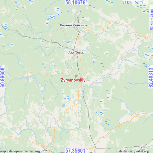
Zyryanovskiy GPS coordinates[2]
57° 43' 59.988" North, 61° 42' 0" East
| Map corner | latitude | longitude |
|---|---|---|
| Upper-left | 58.10676°, | 60.99688° |
| Center: | 57.73333°, | 61.7° |
| Lower-right: | 57.35601°, | 62.40313° |
| Map W x H: | 83.5×83.5 km | = 51.9×51.9mi |
| max Lat: | 73.50819° ⇑18.8% North |
| Zyryanovskiy: | 57.73333° |
| min Lat: | ⇓81.2% South 41.28413° |
| min Long | Zyryanovskiy | max Long |
| -179.12198° | 61.7° | 179.35046° |
| W 74.2%⇐ | ⇒25.8% E |
Elevation
Elevation of Zyryanovskiy is 173 m = 568 ft, and this is 29.6 m = 97 ft below average elevation for this country.
| Max E: |
2518 m = 8261 ft | 38.4% |
| Avg. | 202.6 m = 665 ft | |
| Zyryanovskiy | 173 m = 568 ft | |
Min E: |
-28 m = -92 ft | 61.6% |
See also: Russia elevation on elevation.city.
Geographical zone
Zyryanovskiy is located in North temperate zone (between Tropic of Cancer and the Arctic Circle). Distance of this North polar circle is 981.8 km =610.1 mi to North.| Distance of | km | miles | from Zyryanovskiy |
|---|---|---|---|
| North Pole | 3587.7 | 2229.3 | to North |
| Arctic Circle | 981.8 | 610.1 | to North |
| Tropic Cancer | 3813.4 | 2369.5 | to South |
| Equator | 6419.3 | 3988.8 | to South |


Nearby cities:
15 places around Zyryanovskiy: (largest is in red/bold)
• Alapayevsk
13.2 km =8.2 mi,  359°
359°
• Artëmovskiy
43.2 km =26.8 mi,  166°
166°
• Asbestovskiy
18.2 km =11.3 mi,  277°
277°
• Bulanash
53.6 km =33.3 mi,  160°
160°
• Izumrud
75 km =46.6 mi,  193°
193°
• Krasnogvardeyskiy
54 km =33.6 mi,  136°
136°
• Malysheva
70.6 km =43.9 mi, 194°
• Neyvo-Shaytanskiy
26.7 km =16.6 mi,  268°
268°
• Nizhnyaya Salda
69.4 km =43.1 mi,  303°
303°
• Nizhnyaya Sinyachikha
24.3 km =15.1 mi,  9°
9°
• Petrokamenskoye
62.5 km =38.8 mi, 268°
• Reftinskiy
71.5 km =44.4 mi,  181°
181°
• Rezh
44.1 km =27.4 mi,  203°
203°
• Verkhnyaya Sinyachikha
27.1 km =16.8 mi, 355°
• Zaykovo
65.7 km =40.8 mi,  106°
106°
Sources, notices
• [Note1] Compared only with cities in Russia existing in our database
• [Src1] Map data: © OpenStreetMap contributors (CC-BY-SA)
• [Src2] Other city data from geonames.org with taken over terms of usage.
• [Src3] Geographical zone / Annual Mean Temperature by Robert A. Rohde @ Wikipedia
