Verkhnyaya Sinyachikha geodata
Verkhnyaya Sinyachikha (Sverdlovsk) is a populated place; located in Russia in Asia/Yekaterinburg (GMT+5) time zone. With population of 10,964 people, there are 1379 cities with bigger population in this country. Compared to other cities in Russia, 82.5% of cities are located further ↓South; 74.1% of cities are located further ←West and 65% of cities have higher elevation than Verkhnyaya Sinyachikha. Note1


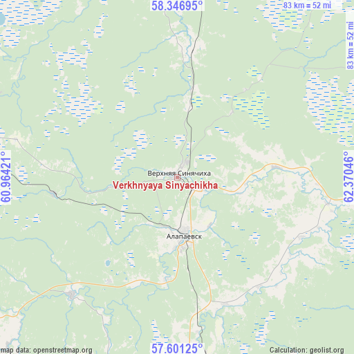
Verkhnyaya Sinyachikha GPS coordinates[2]
57° 58' 33.744" North, 61° 40' 2.388" East
| Map corner | latitude | longitude |
|---|---|---|
| Upper-left | 58.34695°, | 60.96421° |
| Center: | 57.97604°, | 61.66733° |
| Lower-right: | 57.60125°, | 62.37046° |
| Map W x H: | 82.9×82.9 km | = 51.5×51.5mi |
| max Lat: | 73.50819° ⇑17.5% North |
| Verkhnyaya Sinyachikha: | 57.97604° |
| min Lat: | ⇓82.5% South 41.28413° |
| min Long | Verkhnyaya Siny | max Long |
| -179.12198° | 61.66733° | 179.35046° |
| W 74.1%⇐ | ⇒25.9% E |
Elevation
Elevation of Verkhnyaya Sinyachikha is 114 m = 374 ft, and this is 88.6 m = 291 ft below average elevation for this country.
| Max E: |
2518 m = 8261 ft | 65% |
| Avg. | 202.6 m = 665 ft | |
| Verkhnyaya Sinyachikha | 114 m = 374 ft | |
Min E: |
-28 m = -92 ft | 35% |
See also: Russia elevation on elevation.city.
Geographical zone
Verkhnyaya Sinyachikha is located in North temperate zone (between Tropic of Cancer and the Arctic Circle). Distance of this North polar circle is 954.8 km =593.3 mi to North.| Distance of | km | miles | from Verkhnyaya Sinyachikha |
|---|---|---|---|
| North Pole | 3560.7 | 2212.5 | to North |
| Arctic Circle | 954.8 | 593.3 | to North |
| Tropic Cancer | 3840.4 | 2386.3 | to South |
| Equator | 6446.3 | 4005.5 | to South |


Nearby cities:
15 places around Verkhnyaya Sinyachikha: (largest is in red/bold)
• Alapayevsk
13.9 km =8.6 mi,  172°
172°
• Artëmovskiy
70 km =43.5 mi, 170°
• Asbestovskiy
29.3 km =18.2 mi,  213°
213°
• Bulanash
80 km =49.7 mi, 165°
• Karpuninskiy
82.7 km =51.4 mi,  5°
5°
• Krasnogvardeyskiy
76.9 km =47.8 mi,  149°
149°
• Neyvo-Shaytanskiy
37 km =23 mi,  221°
221°
• Nizhnyaya Salda
56.9 km =35.4 mi,  281°
281°
• Nizhnyaya Sinyachikha
6.8 km =4.2 mi,  116°
116°
• Petrokamenskoye
66.9 km =41.6 mi,  244°
244°
• Rezh
69.2 km =43 mi,  193°
193°
• Svobodnyy
75.2 km =46.7 mi, 275°
• Verkhnyaya Salda
65.8 km =40.9 mi, 277°
• Zaykovo
79.4 km =49.3 mi,  125°
125°
• Zyryanovskiy
27.1 km =16.8 mi,  175°
175°
Sources, notices
• [Note1] Compared only with cities in Russia existing in our database
• [Src1] Map data: © OpenStreetMap contributors (CC-BY-SA)
• [Src2] Other city data from geonames.org with taken over terms of usage.
• [Src3] Geographical zone / Annual Mean Temperature by Robert A. Rohde @ Wikipedia
