Nizhnyaya Salda geodata
Nizhnyaya Salda (Sverdlovsk) is a populated place; located in Russia in Asia/Yekaterinburg (GMT+5) time zone. With population of 17,473 people, there are 978 cities with bigger population in this country. Compared to other cities in Russia, 83% of cities are located further ↓South; 72.8% of cities are located further ←West and 59.5% of cities have lower elevation than Nizhnyaya Salda. Note1


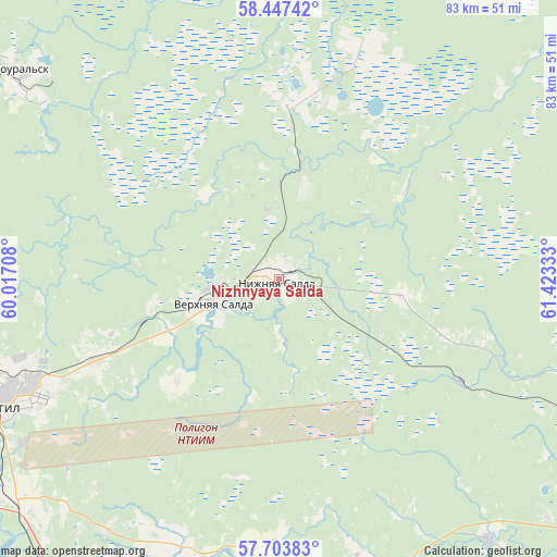
Nizhnyaya Salda GPS coordinates[2]
58° 4' 39.216" North, 60° 43' 12.72" East
| Map corner | latitude | longitude |
|---|---|---|
| Upper-left | 58.44742°, | 60.01708° |
| Center: | 58.07756°, | 60.7202° |
| Lower-right: | 57.70383°, | 61.42333° |
| Map W x H: | 82.7×82.7 km | = 51.4×51.4mi |
| max Lat: | 73.50819° ⇑17% North |
| Nizhnyaya Salda: | 58.07756° |
| min Lat: | ⇓83% South 41.28413° |
| min Long | Nizhnyaya Salda | max Long |
| -179.12198° | 60.7202° | 179.35046° |
| W 72.8%⇐ | ⇒27.2% E |
Elevation
Elevation of Nizhnyaya Salda is 167 m = 548 ft, and this is 35.6 m = 117 ft below average elevation for this country.
| Max E: |
2518 m = 8261 ft | 40.5% |
| Avg. | 202.6 m = 665 ft | |
| Nizhnyaya Salda | 167 m = 548 ft | |
Min E: |
-28 m = -92 ft | 59.5% |
See also: Russia elevation on elevation.city.
Geographical zone
Nizhnyaya Salda is located in North temperate zone (between Tropic of Cancer and the Arctic Circle). Distance of this North polar circle is 943.6 km =586.3 mi to North.| Distance of | km | miles | from Nizhnyaya Salda |
|---|---|---|---|
| North Pole | 3549.4 | 2205.5 | to North |
| Arctic Circle | 943.6 | 586.3 | to North |
| Tropic Cancer | 3851.7 | 2393.3 | to South |
| Equator | 6457.6 | 4012.6 | to South |


Nearby cities:
15 places around Nizhnyaya Salda: (largest is in red/bold)
• Alapayevsk
62.8 km =39 mi,  113°
113°
• Asbestovskiy
53.6 km =33.3 mi,  131°
131°
• Baranchinskiy
60.7 km =37.7 mi,  278°
278°
• Chernoistochinsk
62.8 km =39 mi,  232°
232°
• Krasnoural’sk
51 km =31.7 mi,  308°
308°
• Kushva
61.1 km =38 mi,  292°
292°
• Neyvo-Shaytanskiy
49.8 km =30.9 mi,  141°
141°
• Nikolo-Pavlovskoye
51 km =31.7 mi, 230°
• Nizhny Tagil
47.8 km =29.7 mi,  248°
248°
• Novoasbest
45.2 km =28.1 mi,  214°
214°
• Petrokamenskoye
40.4 km =25.1 mi,  186°
186°
• Svobodnyy
19.5 km =12.1 mi,  257°
257°
• Verkhnyaya Salda
10 km =6.2 mi, 251°
• Verkhnyaya Sinyachikha
56.9 km =35.4 mi,  101°
101°
• Verkhnyaya Tura
62.1 km =38.6 mi,  300°
300°
Sources, notices
• [Note1] Compared only with cities in Russia existing in our database
• [Src1] Map data: © OpenStreetMap contributors (CC-BY-SA)
• [Src2] Other city data from geonames.org with taken over terms of usage.
• [Src3] Geographical zone / Annual Mean Temperature by Robert A. Rohde @ Wikipedia
