Pokanayevka geodata
Pokanayevka (Krasnoyarskiy) is a populated place; located in Russia in Asia/Krasnoyarsk (GMT+7) time zone. With population of 723 people, there are 4795 cities with bigger population in this country. Compared to other cities in Russia, 72.9% of cities are located further ↓South; 87.7% of cities are located further ←West and 78.4% of cities have lower elevation than Pokanayevka. Note1


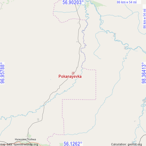
Pokanayevka GPS coordinates[2]
56° 30' 57.96" North, 97° 39' 39.6" East
| Map corner | latitude | longitude |
|---|---|---|
| Upper-left | 56.90203°, | 96.95788° |
| Center: | 56.5161°, | 97.661° |
| Lower-right: | 56.1262°, | 98.36413° |
| Map W x H: | 86.3×86.3 km | = 53.6×53.6mi |
| max Lat: | 73.50819° ⇑27.1% North |
| Pokanayevka: | 56.5161° |
| min Lat: | ⇓72.9% South 41.28413° |
| min Long | Pokanayevka | max Long |
| -179.12198° | 97.661° | 179.35046° |
| W 87.7%⇐ | ⇒12.3% E |
Elevation
Elevation of Pokanayevka is 237 m = 778 ft, and this is 34.4 m = 113 ft above average elevation for this country.
| Max E: |
2518 m = 8261 ft | 21.6% |
| Pokanayevka | 237 m 778 ft | |
| Avg. | 202.6 m = 665 ft | |
Min E: |
-28 m = -92 ft | 78.4% |
See also: Russia elevation on elevation.city.
Geographical zone
Pokanayevka is located in North temperate zone (between Tropic of Cancer and the Arctic Circle). Distance of this North polar circle is 1117.2 km =694.2 mi to North.| Distance of | km | miles | from Pokanayevka |
|---|---|---|---|
| North Pole | 3723.1 | 2313.4 | to North |
| Arctic Circle | 1117.2 | 694.2 | to North |
| Tropic Cancer | 3678.1 | 2285.5 | to South |
| Equator | 6284 | 3904.7 | to South |


Nearby cities:
15 places around Pokanayevka: (largest is in red/bold)
• Aban
99.3 km =61.7 mi,  280°
280°
• Alzamay
123.6 km =76.8 mi,  149°
149°
• Biryusinsk
62.3 km =38.7 mi,  170°
170°
• Chunoyar
105.6 km =65.6 mi,  349°
349°
• Ilanskiy
103.2 km =64.1 mi,  252°
252°
• Kansk
124.7 km =77.5 mi, 253°
• Kvitok
70.7 km =43.9 mi,  134°
134°
• Lesogorsk
121.5 km =75.5 mi,  115°
115°
• Nizhniy Ingash
77.6 km =48.2 mi,  243°
243°
• Nizhnyaya Poyma
48.1 km =29.9 mi,  215°
215°
• Novobiryusinskiy
49.2 km =30.6 mi,  3°
3°
• Shitkino
45.6 km =28.3 mi,  110°
110°
• Tayshet
68.1 km =42.3 mi,  161°
161°
• Tinskoy
61.2 km =38 mi,  228°
228°
• Yurty
51.9 km =32.2 mi,  181°
181°
Sources, notices
• [Note1] Compared only with cities in Russia existing in our database
• [Src1] Map data: © OpenStreetMap contributors (CC-BY-SA)
• [Src2] Other city data from geonames.org with taken over terms of usage.
• [Src3] Geographical zone / Annual Mean Temperature by Robert A. Rohde @ Wikipedia
