Nizhnyaya Poyma geodata
Nizhnyaya Poyma (Krasnoyarskiy) is a populated place; located in Russia in Asia/Krasnoyarsk (GMT+7) time zone. With population of 9,560 people, there are 1580 cities with bigger population in this country. Compared to other cities in Russia, 68.8% of cities are located further ↓South; 87.6% of cities are located further ←West and 81.4% of cities have lower elevation than Nizhnyaya Poyma. Note1


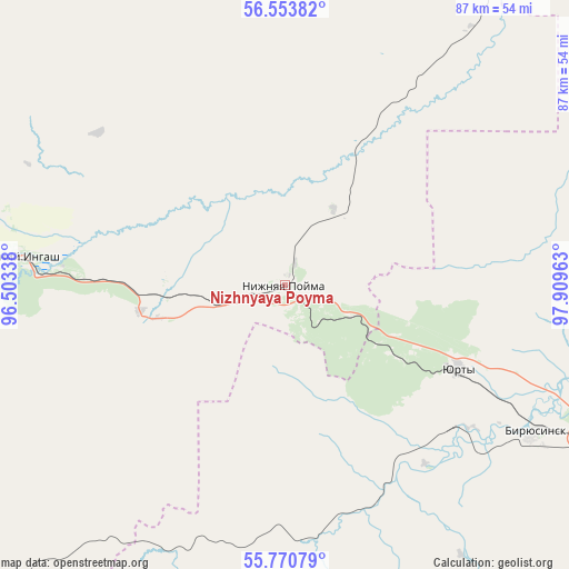
Nizhnyaya Poyma GPS coordinates[2]
56° 9' 51.48" North, 97° 12' 23.4" East
| Map corner | latitude | longitude |
|---|---|---|
| Upper-left | 56.55382°, | 96.50338° |
| Center: | 56.1643°, | 97.2065° |
| Lower-right: | 55.77079°, | 97.90963° |
| Map W x H: | 87.1×87.1 km | = 54.1×54.1mi |
| max Lat: | 73.50819° ⇑31.2% North |
| Nizhnyaya Poyma: | 56.1643° |
| min Lat: | ⇓68.8% South 41.28413° |
| min Long | Nizhnyaya Poyma | max Long |
| -179.12198° | 97.2065° | 179.35046° |
| W 87.6%⇐ | ⇒12.4% E |
Elevation
Elevation of Nizhnyaya Poyma is 264 m = 866 ft, and this is 61.4 m = 201 ft above average elevation for this country.
| Max E: |
2518 m = 8261 ft | 18.6% |
| Nizhnyaya Poyma | 264 m 866 ft | |
| Avg. | 202.6 m = 665 ft | |
Min E: |
-28 m = -92 ft | 81.4% |
See also: Russia elevation on elevation.city.
Geographical zone
Nizhnyaya Poyma is located in North temperate zone (between Tropic of Cancer and the Arctic Circle). Distance of this North polar circle is 1156.3 km =718.5 mi to North.| Distance of | km | miles | from Nizhnyaya Poyma |
|---|---|---|---|
| North Pole | 3762.2 | 2337.7 | to North |
| Arctic Circle | 1156.3 | 718.5 | to North |
| Tropic Cancer | 3639 | 2261.2 | to South |
| Equator | 6244.9 | 3880.4 | to South |


Nearby cities:
15 places around Nizhnyaya Poyma: (largest is in red/bold)
• Aban
90.5 km =56.2 mi,  309°
309°
• Alzamay
113.3 km =70.4 mi,  126°
126°
• Biryusinsk
44.3 km =27.5 mi,  120°
120°
• Filimonovo
108.1 km =67.2 mi,  272°
272°
• Ilanskiy
71 km =44.1 mi,  276°
276°
• Irbeyskoye
124 km =77.1 mi,  241°
241°
• Kansk
92.2 km =57.3 mi, 272°
• Kvitok
79.7 km =49.5 mi,  97°
97°
• Nizhniy Ingash
41.6 km =25.8 mi, 275°
• Novobiryusinskiy
93.4 km =58 mi,  19°
19°
• Pokanayevka
48.1 km =29.9 mi,  35°
35°
• Shitkino
74.5 km =46.3 mi,  72°
72°
• Tayshet
55.8 km =34.7 mi, 117°
• Tinskoy
18 km =11.2 mi, 265°
• Yurty
29.5 km =18.3 mi, 115°
Sources, notices
• [Note1] Compared only with cities in Russia existing in our database
• [Src1] Map data: © OpenStreetMap contributors (CC-BY-SA)
• [Src2] Other city data from geonames.org with taken over terms of usage.
• [Src3] Geographical zone / Annual Mean Temperature by Robert A. Rohde @ Wikipedia
