Yurty geodata
Yurty (Irkutsk Oblast) is a populated place; located in Russia in Asia/Irkutsk (GMT+8) time zone. With population of 5,902 people, there are 2295 cities with bigger population in this country. Compared to other cities in Russia, 67.3% of cities are located further ↓South; 87.7% of cities are located further ←West and 84% of cities have lower elevation than Yurty. Note1


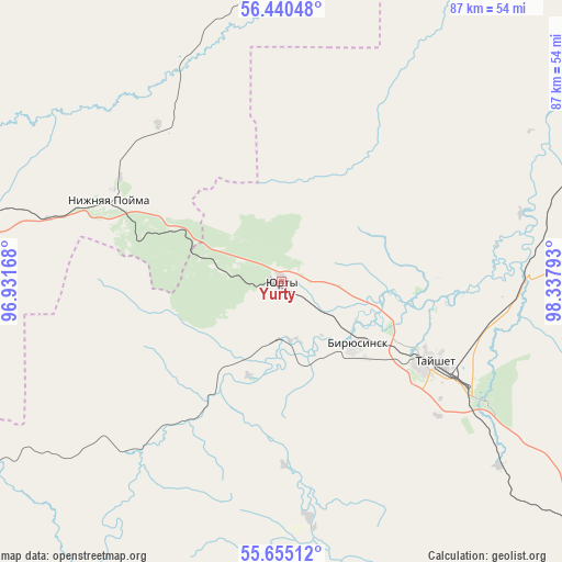
Yurty GPS coordinates[2]
56° 2' 59.28" North, 97° 38' 5.28" East
| Map corner | latitude | longitude |
|---|---|---|
| Upper-left | 56.44048°, | 96.93168° |
| Center: | 56.0498°, | 97.6348° |
| Lower-right: | 55.65512°, | 98.33793° |
| Map W x H: | 87.3×87.3 km | = 54.2×54.2mi |
| max Lat: | 73.50819° ⇑32.7% North |
| Yurty: | 56.0498° |
| min Lat: | ⇓67.3% South 41.28413° |
| min Long | Yurty | max Long |
| -179.12198° | 97.6348° | 179.35046° |
| W 87.7%⇐ | ⇒12.3% E |
Elevation
Elevation of Yurty is 301 m = 988 ft, and this is 98.4 m = 323 ft above average elevation for this country.
| Max E: |
2518 m = 8261 ft | 16% |
| Yurty | 301 m 988 ft | |
| Avg. | 202.6 m = 665 ft | |
Min E: |
-28 m = -92 ft | 84% |
See also: Russia elevation on elevation.city.
Geographical zone
Yurty is located in North temperate zone (between Tropic of Cancer and the Arctic Circle). Distance of this North polar circle is 1169 km =726.4 mi to North.| Distance of | km | miles | from Yurty |
|---|---|---|---|
| North Pole | 3774.9 | 2345.6 | to North |
| Arctic Circle | 1169 | 726.4 | to North |
| Tropic Cancer | 3626.2 | 2253.2 | to South |
| Equator | 6232.2 | 3872.5 | to South |


Nearby cities:
15 places around Yurty: (largest is in red/bold)
• Aban
119.3 km =74.1 mi,  305°
305°
• Alzamay
84.6 km =52.6 mi,  130°
130°
• Biryusinsk
15.2 km =9.4 mi, 129°
• Ilanskiy
99.3 km =61.7 mi,  281°
281°
• Kansk
120 km =74.6 mi, 278°
• Kvitok
52.6 km =32.7 mi,  87°
87°
• Lesogorsk
112.2 km =69.7 mi, 90°
• Lesogorsk
116.7 km =72.5 mi, 90°
• Nizhniy Ingash
70 km =43.5 mi, 283°
• Nizhnyaya Poyma
29.5 km =18.3 mi,  295°
295°
• Novobiryusinskiy
101.1 km =62.8 mi,  2°
2°
• Pokanayevka
51.9 km =32.2 mi, 1°
• Shitkino
57 km =35.4 mi,  51°
51°
• Tayshet
26.3 km =16.3 mi,  119°
119°
• Tinskoy
45.9 km =28.5 mi, 284°
Sources, notices
• [Note1] Compared only with cities in Russia existing in our database
• [Src1] Map data: © OpenStreetMap contributors (CC-BY-SA)
• [Src2] Other city data from geonames.org with taken over terms of usage.
• [Src3] Geographical zone / Annual Mean Temperature by Robert A. Rohde @ Wikipedia
