Shitkino geodata
Shitkino (Irkutsk Oblast) is a populated place; located in Russia in Asia/Irkutsk (GMT+8) time zone. With population of 2,363 people, there are 4012 cities with bigger population in this country. Compared to other cities in Russia, 71.3% of cities are located further ↓South; 87.8% of cities are located further ←West and 75.4% of cities have lower elevation than Shitkino. Note1


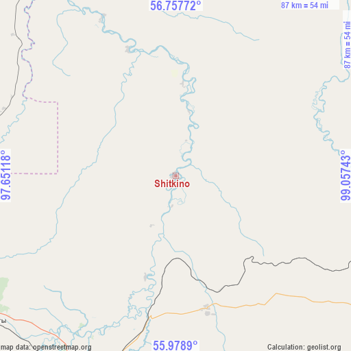
Shitkino GPS coordinates[2]
56° 22' 13.08" North, 98° 21' 15.48" East
| Map corner | latitude | longitude |
|---|---|---|
| Upper-left | 56.75772°, | 97.65118° |
| Center: | 56.3703°, | 98.3543° |
| Lower-right: | 55.9789°, | 99.05743° |
| Map W x H: | 86.6×86.6 km | = 53.8×53.8mi |
| max Lat: | 73.50819° ⇑28.7% North |
| Shitkino: | 56.3703° |
| min Lat: | ⇓71.3% South 41.28413° |
| min Long | Shitkino | max Long |
| -179.12198° | 98.3543° | 179.35046° |
| W 87.8%⇐ | ⇒12.2% E |
Elevation
Elevation of Shitkino is 218 m = 715 ft, and this is 15.4 m = 51 ft above average elevation for this country.
| Max E: |
2518 m = 8261 ft | 24.6% |
| Shitkino | 218 m 715 ft | |
| Avg. | 202.6 m = 665 ft | |
Min E: |
-28 m = -92 ft | 75.4% |
See also: Russia elevation on elevation.city.
Geographical zone
Shitkino is located in North temperate zone (between Tropic of Cancer and the Arctic Circle). Distance of this North polar circle is 1133.4 km =704.3 mi to North.| Distance of | km | miles | from Shitkino |
|---|---|---|---|
| North Pole | 3739.3 | 2323.5 | to North |
| Arctic Circle | 1133.4 | 704.3 | to North |
| Tropic Cancer | 3661.9 | 2275.4 | to South |
| Equator | 6267.8 | 3894.6 | to South |


Nearby cities:
15 places around Shitkino: (largest is in red/bold)
• Alzamay
92.6 km =57.5 mi,  167°
167°
• Biryusinsk
55.9 km =34.7 mi,  215°
215°
• Chunoyar
135.1 km =83.9 mi,  332°
332°
• Chunskiy
85.4 km =53.1 mi,  112°
112°
• Ilanskiy
142 km =88.2 mi,  263°
263°
• Kvitok
34 km =21.1 mi, 166°
• Lesogorsk
76.1 km =47.3 mi,  117°
117°
• Lesogorsk
80.3 km =49.9 mi, 116°
• Nizhniy Ingash
113.7 km =70.6 mi, 260°
• Nizhnyaya Poyma
74.5 km =46.3 mi,  252°
252°
• Novobiryusinskiy
76.3 km =47.4 mi, 328°
• Pokanayevka
45.6 km =28.3 mi,  290°
290°
• Tayshet
53.1 km =33 mi,  204°
204°
• Tinskoy
92 km =57.2 mi, 254°
• Yurty
57 km =35.4 mi,  231°
231°
Sources, notices
• [Note1] Compared only with cities in Russia existing in our database
• [Src1] Map data: © OpenStreetMap contributors (CC-BY-SA)
• [Src2] Other city data from geonames.org with taken over terms of usage.
• [Src3] Geographical zone / Annual Mean Temperature by Robert A. Rohde @ Wikipedia
