Linëvo geodata
Linëvo (Novosibirsk Oblast) is a populated place; located in Russia in Asia/Novosibirsk (GMT+7) time zone. With population of 21,816 people, there are 822 cities with bigger population in this country. Compared to other cities in Russia, 51.3% of cities are located further ↑North; 80.8% of cities are located further ←West and 73% of cities have lower elevation than Linëvo. Note1


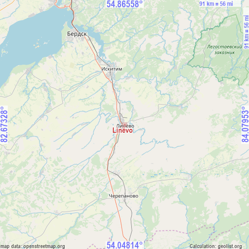
Linëvo GPS coordinates[2]
54° 27' 32.04" North, 83° 22' 35.04" East
| Map corner | latitude | longitude |
|---|---|---|
| Upper-left | 54.86558°, | 82.67328° |
| Center: | 54.4589°, | 83.3764° |
| Lower-right: | 54.04814°, | 84.07953° |
| Map W x H: | 90.9×90.9 km | = 56.5×56.5mi |
| max Lat: | 73.50819° ⇑51.3% North |
| Linëvo: | 54.4589° |
| min Lat: | ⇓48.7% South 41.28413° |
| min Long | Linëvo | max Long |
| -179.12198° | 83.3764° | 179.35046° |
| W 80.8%⇐ | ⇒19.2% E |
Elevation
Elevation of Linëvo is 208 m = 682 ft, and this is 5.4 m = 18 ft above average elevation for this country.
| Max E: |
2518 m = 8261 ft | 27% |
| Linëvo | 208 m 682 ft | |
| Avg. | 202.6 m = 665 ft | |
Min E: |
-28 m = -92 ft | 73% |
See also: Russia elevation on elevation.city.
Geographical zone
Linëvo is located in North temperate zone (between Tropic of Cancer and the Arctic Circle). Distance of this North polar circle is 1345.9 km =836.3 mi to North.| Distance of | km | miles | from Linëvo |
|---|---|---|---|
| North Pole | 3951.8 | 2455.5 | to North |
| Arctic Circle | 1345.9 | 836.3 | to North |
| Tropic Cancer | 3449.3 | 2143.3 | to South |
| Equator | 6055.3 | 3762.6 | to South |


Nearby cities:
15 places around Linëvo: (largest is in red/bold)
• Akademgorodok
47.1 km =29.3 mi,  338°
338°
• Baryshevo
56.7 km =35.2 mi,  347°
347°
• Berdsk
37.5 km =23.3 mi,  331°
331°
• Cherepanovo
26.3 km =16.3 mi,  179°
179°
• Dorogino
11.6 km =7.2 mi,  198°
198°
• Iskitim
20.3 km =12.6 mi, 346°
• Kol’tsovo
54.7 km =34 mi, 346°
• Krasnoobsk
56.9 km =35.4 mi, 334°
• Listvyanskiy
8.2 km =5.1 mi,  104°
104°
• Maslyanino
55.5 km =34.5 mi, 103°
• Novolugovoye
60.3 km =37.5 mi, 343°
• Novosibirsk
70.7 km =43.9 mi, 336°
• Tolmachëvo
71.3 km =44.3 mi,  324°
324°
• Verkh-Tula
61 km =37.9 mi, 320°
• Yarkovo
63.2 km =39.3 mi,  307°
307°
Sources, notices
• [Note1] Compared only with cities in Russia existing in our database
• [Src1] Map data: © OpenStreetMap contributors (CC-BY-SA)
• [Src2] Other city data from geonames.org with taken over terms of usage.
• [Src3] Geographical zone / Annual Mean Temperature by Robert A. Rohde @ Wikipedia
